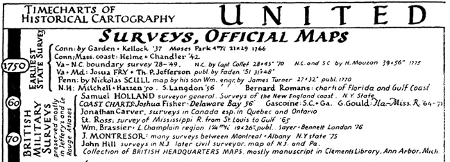
Harvard’s Erwin Raisz (1893-1968) was one of the 20th century’s preeminent cartographers (bio, bio, bio). Most people know of his landform maps, which are still in print. Raisz was also responsible for a series of atlases and hundreds of maps in books and academic articles.
In a 1937 article for the journal Isis entitled “Outline of the History of American Cartography” Raisz generated a pair of “timecharts of historical cartography” covering key events and individuals in American cartographic history, subdivided into official maps/surveys and private cartography.
Excerpts of the charts, for educational purposes, are linked below.
