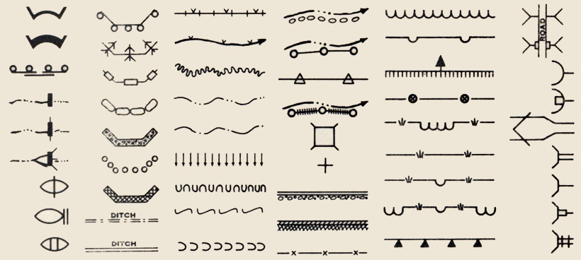
Dams, bulkheads, arches, ditches, flumes, outlet spreaders, outlet baffles, revetments, riprap, fence, gullies, borings, test pits, siphons, retaining walls, culverts, inlet transitions, jump structure, overfall, tree plantings, sheet erosion plantings, streams, lakes, terraces, ground water, water seepage, water limits, drains, percolators … the language of erosion and flood control in 1930s America.
The above symbols are selected from five pages (full PDF below) in Symbols and Instructions for Maps and Plans, a book compiled and published by the U.S. Department of the Interior Office of Indian Affairs in 1941.
