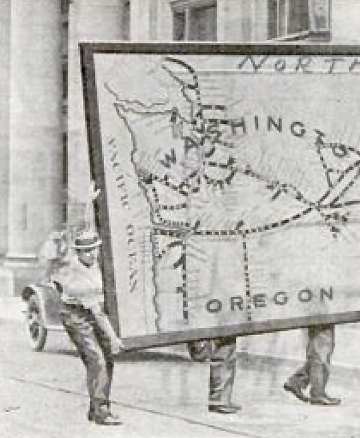
It measures 69 feet long and 11 feet wide and required the services of nearly a dozen men to carry it…
Enormous map moving, ca. 1917.
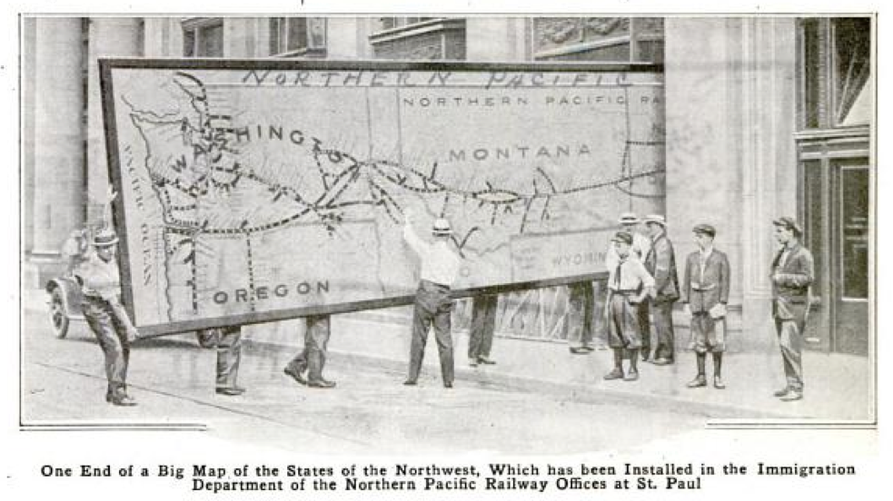
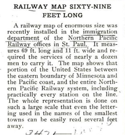
The map shows that portion of the United States between the eastern boundary of Minnesota and the Pacific coast, and the entire Northern Pacific Railway system, including practically every station on the line.
Popular Mechanics, February 1917.

[…] (Via) […]
[…] Image: (image: Popular Mechanics) (Via) […]
[…] Instal·lant el mapa del ferrocarril a l’estació, el 1917:https://makingmaps.net/2013/06/19/moving-enormous-maps-1917/ […]
[…] Source: Making Maps: DIY Cartography […]