
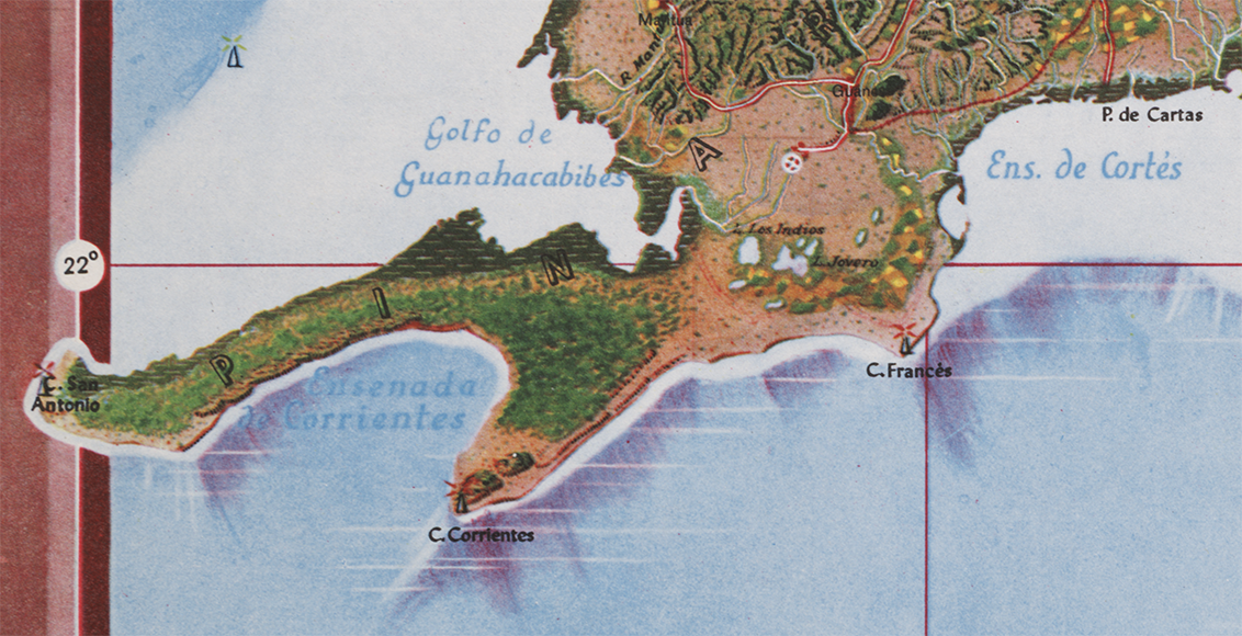
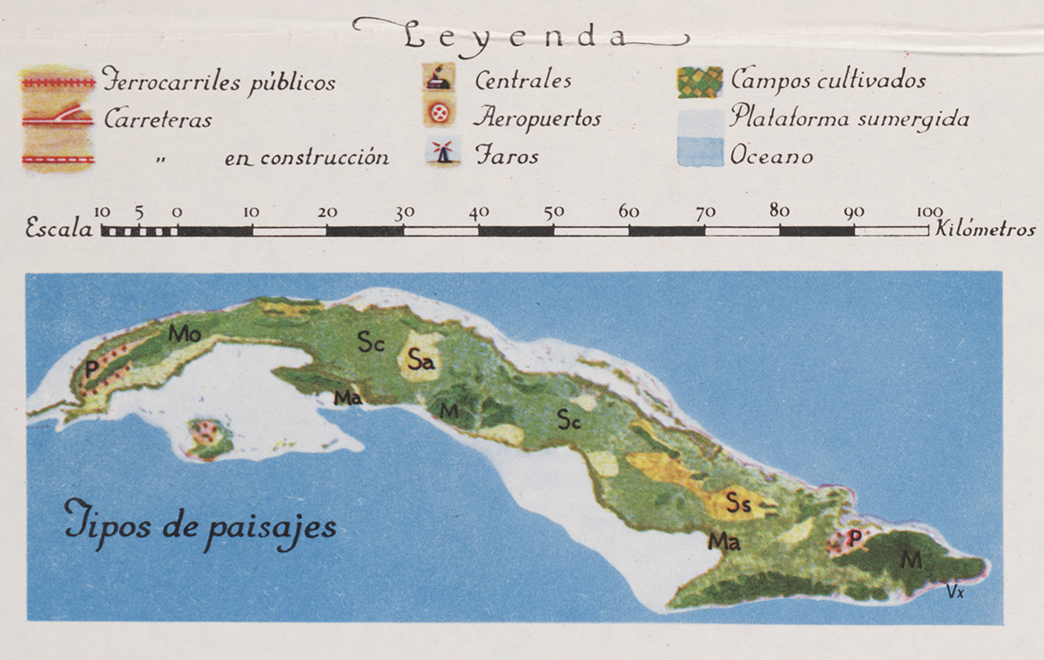
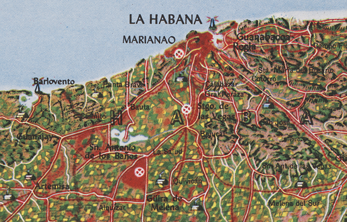
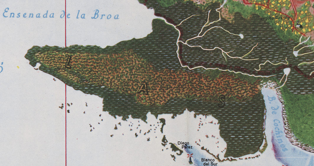
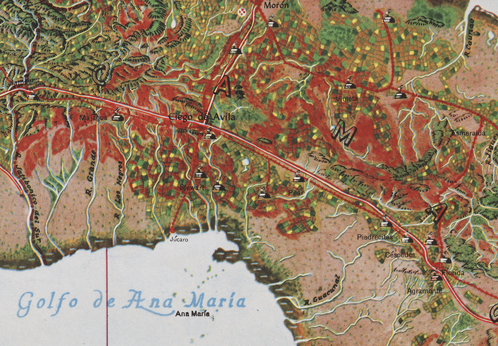
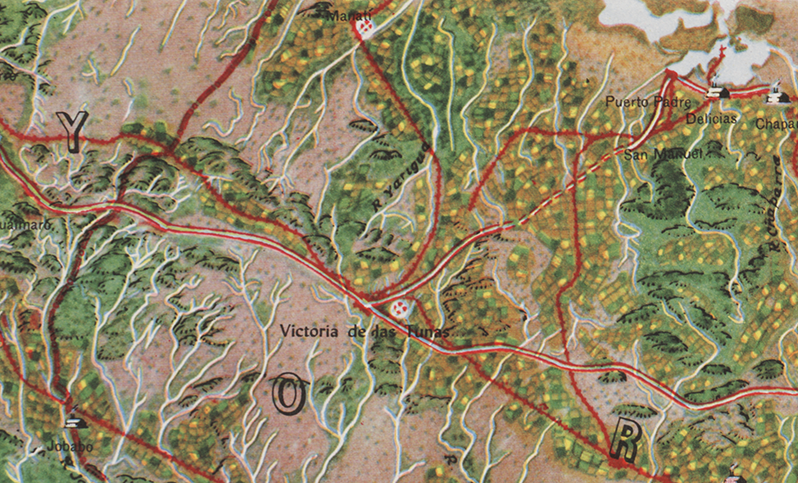
The Atlas de Cuba by Gerardo Canet and Erwin Raisz, featured in a recent posting here, is accompanied by a large color map entitled Mapa de los Paisajes de Cuba (Map of the Landscapes of Cuba). The map is a hybrid of Raisz’s landform map style supplemented with diverse human landscape components. Canet and Raisz explain their methodology:
The accompanying map of Cuba is a new experiment in cartography. Color suggests land types: cultivated fields, pastures, mountains, swamps, valleys, etc. The symbols were selected after a series of flights over the Island and on analysis of numerous color photographs taken from the air It is expected that in this way the map will better reflect reality; more closely resembling on air view of the Island than the conventional maps we now have.
This approach is part of a tradition of natural or real color mapping combining terrain (in particular, shaded relief) with air imagery or map symbolization inspired by air imagery, an obvious outcome of aerial mapping in the early part of the 20th century. An article by Tom Patterson and Nathaniel Vaughn Kelso entitled Hal Shelton Revisited: Designing and Producing Natural-Color Maps with Satellite Land Cover Data (2004) delineates the author’s development of the Natural Earth data (shaded terrain + satellite land use data) in the context of earlier, related work by Hal Shelton, Eduard Imhof, Heinrich Berann, Richard Edes Harrison and Tibor Toth. It seems that Raisz was also an innovator in this realm of air-imagery inspired map design.
••••••••••••
See also, at this blog, Raisz’s History of American Cartography Timelines, Map Symbols: Landforms & Terrain, and Raisz’s currently available landform maps at www.raiszmaps.com.
••••••••••••

Mapa de los Paisajes de Cuba, 1949 (36.6mb)
••••••••••••••••••
Map details:


Beautiful!!
No one knew how to break out past the neatline like Erwin Raisz! (I’m talking about https://makingmaps.files.wordpress.com/2014/07/002_cuba_canet_raisz_map.png)
I included that neatine violation especially for you, MVW.
[…] (Via) […]
You mentioned “Mapa de los Paisajes de Cuba, 1949 (36.6mb)” –> Is there a way to download the 36.6 MB file ?
Click on the full map and the 36.6mb file should open in your browser. Right mouse click to save to your desktop. If that does not work, let me know.
[…] “The Industrial South” (Fortune, November 18, 1938) is not unlike the style of Erwin Raisz (previously, on this blog) in its use of pictorial map […]
Es posible adquirir el Atlas de Cuba, 1849 de Gerardo A. Claret ?
I will be selling an original example of this map in early 2020. If interested, contact me. My company is New World Cartographic.
I will be selling an original example of this map in early 2020. If interested, contact my company, New World Cartographic.