Feeds:
Posts
Comments

Three terrific new books on maps and mapping…

Review by Denis Wood

Linda Campbell, Andrew Newman, Sara Safransky, and Tim Stallman, eds., A People’s Atlas of Detroit (Wayne State University Press, Detroit, 2020).

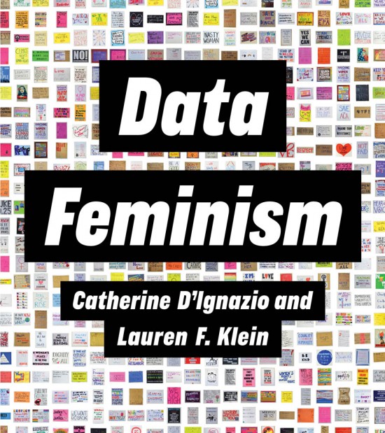
Catherine D’Ignazio and Lauren Klein. Data Feminism (MIT Press, Cambridge, 2020).

Rasmus Grønfeldt Winther. When Maps Become the World (University of Chicago Press, Chicago, 2020).

I read these three books in order, one after the other, with ever increasing pleasure. A Blacks’ atlas of Detroit, two women writing about data from a feminist perspective, a philosopher of science using “map thinking” to mull over everything from geodetic surveys to genetics – these books could have been deadly, a sure prescription for eyes glazed-over as the books slipped from my fingers to the floor. Instead: great interest, continuous surprises, and mounting satisfaction.

Reading about Detroit made me think about growing up in Cleveland. Cleveland was an exciting place to live in the 1940s and 1950s. Its Terminal Tower was the tallest building in the world (outside of New York). In 1946 George Szell began conducting its symphony and in 1948 the Indians won the World Series. Thousands worked in the city’s steel mills. It had a fabulous streetcar system. Walking down Euclid Avenue in those days was like walking down Fifth Avenue in New York, just that crowded and exciting. Forty years later, in the middle of the afternoon, I lay down in the middle of Euclid Avenue and had to wait four minutes before a car came along to honk me out of the way. The place was a desert. When I was growing up Cleveland was the seventh largest city in the US. It’s the 53rd now and it feels it. It’s shrunken. It’s had its guts ripped out of it.

Back in those days Detroit was the fifth largest city in the US. It was Motor City, where the cars came from and, soon enough, Motown where the songs came from. Detroit’s fall was like Cleveland’s, though if you believed what you read it was actually much, much worse. Unlike Cleveland, Detroit was always in the news. Its miles of deserted, flattened blocks became notorious. The city went bankrupt, and it was taken over by a state-imposed manager. He wanted to sell the paintings out of the art museum! The place was an unmitigated disaster. Reading this stuff you’d never believe that Detroit, with its 670,000 inhabitants, is still the 23rd largest city in the US, that Metro Detroit with its 4.3 million inhabitants is the nation’s fourteenth, or that the art museum with its 677,000 annual visitors is among the most visited in the world. That is, you’d never believe that rather than a horrifying wasteland, Detroit’s an exciting, a vibrant place to live, maybe especially for the Blacks who man (and woman!) the front lines of a fierce struggle against racism, revanchism, and capitalism. This struggle is the subject of A People’s Atlas of Detroit.

The book’s introduction clarifies what it means by “people’s” and “atlas”. Not an atlas of all the peoples of Detroit – an atlas of Detroit – the book’s a collection of texts and maps (there are nearly four dozen of these) that illuminates a moment in the struggle of Black Detroiters for their city; and although it was published in 2020, that moment was essentially 2012 when most of the interviews here were collected. Laid out in six chapters, their titles capture the book’s contents: “Detroit and the Long Struggle for Liberation,” “This Land is Ours: Toward a New Urban Commons,” “Growing a Revolution,” “Suspending Democracy Is Violence,” “Gentrification Is Only Part of It: Understanding Race and Displacement in Detroit,” and “The Right to the City.” Each of these runs to some fifty pages of maps but, mostly, texts, texts drawn from the people the book’s about.

Take Grace Lee Boggs and Sterling Toles who have a conversation at the end of the first chapter. Grace Lee, the daughter of Chinese immigrants, married the Alabama-born African-American and Chrysler auto worker, James Boggs, in 1953, and in 1974 these two activists and “fiercely independent intellectuals” published Revolution and Evolution in the Twentieth Century which, still very much in print (along with the rest of their work), remains a key text for radical thinking. Toles, on the other hand, is “an illustrator, sound sculptor, DJ and music producer” who runs a recording studio out of his home. While you might imagine that Toles would be interviewing Boggs, it turns out to be the other way around, Boggs probing Toles about his work with the local kids who’d been censored at other studios: “My whole thing was, I wouldn’t censor them, but I would ask them why they felt what they felt. One of the premises that I really work on is that so much of this culture is about conduct, control, and behavior control as opposed to nourishment,” which leads into talk about “nurturing.” After James Boggs died, in 1993, the James and Grace Lee Boggs Center to Nurture Community Leadership was founded, and “nurture” turns out to be a theme that that runs throughout A People’s Atlas of Detroit.

The whole book’s like this, insanely dense. Take the cover. While a piece of a street map fills the sky, otherwise the cover’s a photo of two Black kids walking down a street away from the camera. On the left Crocketts Groceries sells beer and wine. On the right a chain-link fence topped with barbed wire encloses a yard. If you look closely you can see in the distance that the street’s been closed off since, as a note on the back cover makes clear, the photo was taken at “Yusef Shakur’s twelfth annual backpack giveaway and neighborhood festival,” which explains the kids’ shiny new backpacks. Now, I rarely expect book covers to have much to do with the book. Usually they’re designed after the book’s on its way to the press, by a designer who may have only the sketchiest idea of its contents. So it was shock to come across, on page 293, in the introduction to Yusef “Bunchy” Shakur’s “Reclaiming Our Souls,” that Shakur’s coffee shop “is a community space that offers a public computer station, features local art, hosts poetry readings, and organizes an annual back-to-school backpack drive, which is featured on the cover of this book.” I mean, this almost never happens.

But then the whole book’s terrific, building smoothly to the cymbal crash of the concluding chapter, “The Right to the City,” where interviews are presented on the rights to water, to environmental justice, to mobility, to education, and to freedom from crime and police harassment, in each case examining situations in which these rights have been or are denied: the notorious water shutoffs; the serious perils of pollution, with a focus on the city’s incinerator; the problems stemming from the city’s fragmented transit systems; the school closures; and the impact of the city’s insane rates of incarceration. In each case solutions are advanced whereby Detroiters have or are reclaiming these rights, in the process reclaiming, as “Bunchy” Shakur puts it, “our souls.” It’s inspiring, but it’s also a mind-boggling amount of work, work Black Detroiters have embraced. That’s what’s really inspiring!

Data Feminism resources here

Catherine D’Ignazio and Lauren Klein’s Data Feminism is a whole different kettle of fish. A book by two feminist academics explaining why data science needs feminism, it would be hard to imagine anything further from A People’s Atlas of Detroit; and yet it’s animated by a similar spirit of defiant resistance, and it shares with the atlas a determined resolution to address the problems it identifies. These are laid out in seven chapters that follow a welcoming and incisive introduction, and again their titles neatly capture the book’s contents: “The Power Chapter,” “Collect, Analyze, Imagine, Teach,” “ On Rational, Scientific, Objective Viewpoints from Mythical, Imaginary Impossible Standpoints,” “What Gets Counted Counts,” “Unicorns, Janitors, Ninjas, Wizards, and Rock Stars,” “The Numbers Don’t Speak for Themselves,” and “Show Your Work.” An active principle, effectively a subtitle, interpret these: “Examine Power,” “Challenge Power,” “Elevate Emotion and Embodiment,” “Rethink Binaries and Hierarchies,” “Embrace Pluralism,” “Consider Context,” and “Make Labor Visible.”

Each subtitle is then further spelled out in an attached sentence. For example, “Challenge Power,” is followed by “Data Feminism commits to challenging unequal power structures and working toward justice.” This chapter opens with a comparison of the Detroit Geographical Expedition and Institute’s map, Where Commuters Run Over Black Children on the Pointes-Downtown Track, with the Detroit Board of Commerce’s Residential Security Map. The first was made by a collaboration between young Black adults and white academics from local universities, while the second was made by white men collaborating with the Federal Home Loan Bank Board, producing – to cut to the chase – a map of Detroit neighborhoods on which the Black neighborhoods appear in red. This 1939 map is an early instance of what became known as “redlining” maps, denying to most of those who lived within the red borders the ability to borrow money to buy a home. D’Ignazio and Klein compare these redlining maps to the way big data are fetishized today – as rational, scientific, and objective – where what is overlooked is the unequal power structures that underlie and dictate the character of the rational, scientific, and objective data used. In the redlining maps, that character was all about protecting and preserving home ownership as a way of accumulating wealth and power for whites. D’Ignazio and Klein contrast this data with the data underlying the Run Over Black Children map which, previously unavailable, had to be collected from the police (with no little effort), and then compiled and plotted by the young Blacks who lived in the community itself. A sharper example of a challenge to power working toward justice would be hard to imagine.

Each chapter opens with a similarly compelling example, and then proceeds to think through the issues raised, typically through further examples, before closing with another, equally compelling example. In the power chapter the concluding example arises out of an idea called “mathematics for spatial justice,” specifically from a project, Local Lotto, that unfolded in the Bronx. Local Lotto grounded the teaching of statistics and data collection in contexts of equity, specifically the question whether the New York state lottery was good or bad for the neighborhood. The students learned about statistics and data analysis, roamed the neighborhood to collect their data, analyzed it, and gave presentations to each other. Finally they created “a data-driven argument: an opinion piece supported with evidence from their statistical and spatial analyses, as well as their fieldwork.” Again, the challenge to power is in your face and, like so many of the rest of the projects in the book, it’s rich, detailed, many-layered and multi-stranded.

Organizing the book’s arguments is what sociologist Patricia Hill Collins calls “the matrix of domination,” a construct she uses to explain how systems of power are configured and experienced. Her matrix embraces four domains – law and policies; their enforcement; culture and media; and individual experiences of oppression – which D’Ignazio and Klein return to again and again, as in … the question of pocket sizes. Here the larger issue is classification systems, specifically “how race, gender, and class (among other things) intersect to enhance opportunities for some people and constrain opportunities for others.” The examples D’Ignazio and Klein deploy make it clear the the forces operating through the matrix of domination are “sneaky and diffuse”: here, for instance, women’s pants pockets are almost half as long as those for men (that is, they’re too small for a smartphone). Of course this has a history, and it’s one in which the matrix of domination plays a role again and again, and so this difference in pocket sizes leads into a discussion of gender, especially the gender binary, which leads to the issue of binaries in general, which is a big player in what gets counted. That is, binaries are a big constraint on what gets counted.

The example that opens the fifth chapter is San Francisco’s Anti-Eviction Mapping Project, exhibiting (among other things) how “partiality and contestation” can take place in graphical design, thereby upholding the fourth principle of data feminism: the embrace of pluralism. Constructively, this builds on the previous chapter’s dismay over the constraints of binaries, here expanded to a polemic against the cleansing and tidying to which datasets are regularly subjected in order to make them amenable to … well, to simple “yes” or “no” outcomes for what are immensely complicated public debates. As D’Ignazio and Klein conclude the chapter: “embracing pluralism is a feminist strategy for mitigating this risk. It allows both time and space for a range of participants to contribute their knowledge of a data project and to do so at all stages of that project.”

But what’s really great about this book is the way it practices what it preaches. When you reach the end of the text, you don’t reach the end of the book. Instead it continues for another ninety-nine pages, half again as long as the text itself. These open with “Our Values and Our Metrics for Holding Ourselves Accountable,” which opens with an historical note that in turn opens with an allusion to the “open peer review process” that took place online. Okay, that’s unusual enough, but it then proceeds to list their key values: intersectionality, equity, proximity, the humanity of data, reflexivity, transparency, accountability and positionality. As they say, legitimate knowledge “has a race and a gender, as well as a class and geographic location,” concluding that “values are not enough. We have to put those values into action and hold ourselves accountable again and again.” Therefore this section is followed by Isabel Carter’s “Auditing Data Feminism,” which explains how the audit, included in the previous section, was carried out.

After this come “Acknowledgment of Community Organizations,” describing the two organizations to which a portion of the royalties from Data Feminism have been redirected; and, then, detailed “Figure Credits,” sixty-six pages of notes, a name index, and a subject index. And these are some notes. Not your common citations, these are discursive and enriching, expanding the text in the valuable directions. These are notes you don’t mind flipping to the back to read because the content warrants the disruption, or rather the extension, because that’s what they do, they extend the arguments of the text. Footnotes to the redlining text, for example, expand on the way the tactic is still used to deny housing to Blacks, citing among many other cases the one brought in 2018 against Facebook by the Department of Housing and Urban Development for enabling discriminatory advertising by housing providers. At the same time they expanded on the way Gwendolyn Warren’s work on the Run Over Black Children map has been so often misattributed to Bill Bunge (by me among others).

No, this is a good book, meriting a very careful read.

Martin Waldseemüller’s 1507 Universalis cosmographia. “This map is the first known visualization showing America as a separate continent, and naming it as such, in honor of the Florentine explorer Amerigo Vespucci. Waldseemüller’s map is known as the “birth certificate” of America.” Source

When Maps Become the World, by Rasmus Grønfeldt Winther, demands a very careful read, if only to to keep up with the arguments, which are many, mutually-referencing, and continually compounding. Winther is a philosopher of science and this is straight-up philosophy of science. In fact his central thesis is “that science is an overarching mapping project of the world,” a thesis that more than justifies the four-chapter-long explication of what he calls “map-thinking.” “Map thinking,” says Winther, “refers to philosophical reflection concerning what maps are and how they are made and used,” where “philosophical reflection” is precisely that, reflection. But … philosophical reflection: “Map thinking massages the imagination; excavates hidden assumptions; challenges and synthesizes dualisms; and invites us to reflect on space and time – including the future.” This should make plain that When Maps Become the World is discursive, which means, as Merriam-Webster confirms, that it’s: “marked by a method of resolving complex expressions into simpler or more basic ones: marked by analytical reasoning.”

Here the complex expression is “map thinking” and the simpler or more basic things into which it’s resolved include: eight map analogies (e.g., “A scientific theory is a map of the world”), assumption archeology, an abstraction-ontologizing account, partitioning frames, pernicious reification, contextual objectivity with its integration platform, and a multiple representations account. Each of these is in turn resolved into similarly simpler parts, as in the multiple representations account getting thought through ontologizing, merely-seeing-as, and pluralistic ontologizing. Here ontologizing is said to occur “when an individual takes the internal world of a map or scientific representation to really be the world it intends to represent.” In contrast, when merely-seeing-as, a user “comprehends that the content of the map, model, or theory is one limited way of viewing, and acting, in the world.” We’re said to be pluralistically ontologizing when we “communally, deliberately, and mindfully respect multiple representations,” including those unfamiliar or taken-for-granted.

Ontologizing, merely-seeing-as, and pluralistic ontologizing amount to three different postures that can be taken with respect to existence. For example, the ontologist who has grown up with the Mercator projection alone may be inclined to believe Greenland is about the size of Africa, whereas Africa is actually fourteen times the size of Greenland. One who merely-sees-as understands there are other ways to see the world: for example, that offered by the Gall-Peters projection which, while it does show things in their true sizes does not, as does the Mercator, show them in their true shapes. A pluralistic ontologist understands that there are more ways to think about the world than you can squeeze onto a projection, and opens him- or herself up to wholly other world views, ancient, anthropological, or just plain loony (like most contemporary flat-earth apostles). In another domain, Galen’s humoral theory explained disease as an imbalance of the humors. Long and widely ontologized in the West, in the later nineteenth century humoral theory was forced to compete with the then new germ theory of Louis Pasteur and Robert Koch, after which this became, well, the world. Today germ theory is merely-seen-as the explanation for most diseases, dominantly in our age of the coronavirus, but more pluralistic ontologists understand that illness can have many causes, viruses and bacteria, but also radiation and lead poisoning, nutritional deficiencies, stress, and so on.

Maps become the world when either literal maps or scientific theories get mistaken for the world, foreclosing alternatives. Maps like these lurk behind phrases like, “It’s hard to imagine but people used to believe …” before the unfolding of alternative, typically “old-fashioned” views, like that of a flat earth (now spherical), or those with the earth in the center of the universe (which is now at the edge of a minor galaxy), or the one in which ice, water, and steam were different substances (whereas today they’re different phases of a common substance), or that in which different “races” were all but different species (which today are non-existent), or that of the earth without plate tectonics. I grew up in that one, with geologists teaching me geosynclinal theory and making fun of “this plate-tectonic nonsense” which, of course, today is … the world.

Having laid out this way of thinking about the world, with its pernicious reification and contextual objectivity, Winther applies it to science to show it in action, that is, to sciences, since When Maps Become the World takes on no fewer than eight of them. Naturally he starts with the universe which naturally he begins with the Big Bang. Here we begin with the cosmic microwave background map, of the universe shortly after its birth. Winther contrasts this with the map of the current universe created by Margaret Geller and associates in 1977, or at least with the positions of a thousand of its galaxies. Finally Wither turns to the more recent three-dimensional maps of galactic motion, of Hélene Courtois, R. Brent Tully and their team, which track the motions of hundreds of thousands of galaxies. Winther takes this as an opportunity to review his abstraction-ontologizing account with its complicated problems of the calibration of cosmic distances, the collection and management of cosmological data, and their generalization into extreme space maps.

Next he drops his gaze to the earth where, with conventionally scaled geologic mapping, he traces the history and state of plate tectonics; before freaking out with state-space maps in physics and physical chemistry (also known as phase diagrams). Finally he considers analogous maps in mathematics where we not only consider mathematical mappings but the literal cartography of the great German mathematician, Carl Friedrich Gauss, work that through his student Bernhard Riemann’s work on manifolds underwrites all of twentieth century physics. It’s all space and time – Winther makes that case convincingly – and so all this can be thought through the lens of map thinking quite easily.

This proves no less true of the examples in the following chapter where Winther emphasizes the importance of assumption archeology and the power of countermapping. Here he’s tackling our mapping of ourselves: migration mapping, brain mapping, and statistical causal mapping. He opens with the abstractive-averaging assumptions so common under maps of migration, tracing these through the work of Ernst Ravenstein, Waldo Tobler and others. These he counters with, for example, the migrant death mapping of Humane Borders/Fronteras Compasivas; and with the mapping of Tunisian migration by Robby Habans for the Spaces in Migration project of Martina Tazzioli and colleagues. Both of these radically resist the abstractive-averaging assumptions of “mainstream” migration mapping. Winther explores brain mapping the same way, a tour through decompositional assumptions, phrenological maps, and the somatosensory and motor homunculi being followed by the countermaps of Russell Poldrack and Michael Anderson, namely, cognitive ontologies and functional fingerprints. The path diagrams of statistical causal maps get countered by Eric Turkheimer and Helen Longino’s doubts about the utility of the whole approach, opening questions about, for example, the very possibility of decomposing the statistical interactions into the individual behaviors of the interacting individuals, and so asking: what’s being explained?

In his final science chapter Winther turns to genetics (the subject of his forthcoming book), to look at seven genetic maps, integrating them into a paradigmatic integration platform on which he notes each map’s genetic type, its partitioning frame, its space and time frames, and its map type. Take the linear genetic map. Its partitioning frame features morphological character, chromosome bands and nucleotides in chromosomal and nucleotide space in the time that a crossover takes in a germ cell. It’s an extreme-scale map. In contrast the literal genetic map partitions the domain into genes and their relevant geographic regions in geographic space and evolutionary time. It’s a literal geographic map. There’s lots more, some of it completely abstract (the adaptive landscape, for instance). The last chapter embeds all of this, and the seven previous chapters, into the philosophy of science, concluding with an invitation to dream. I think it’s safe to say that the book ends on a high …

It’s only three-hundred pages but When Maps Become the World is a lot of book with a lot of thought-provoking propositions about life and how to live it. Masquerading as a book about maps and science, it’s a manual on how to be in the world, a manual on how to live. Just as D’Ignazio and Klein’s Data Feminism turns out to be a manual on how to write a book (to say nothing of how to deal with data), and A People’s Atlas of Detroit turns out to be a manual on how to stake a claim to a place. They’re all terrific books with claims on our attention far beyond what you’d imagine they might have to offer. Read ‘em!

Matthew H. Edney. Cartography. The Ideal and Its History. xiii + 309 pp., figs., bibl., index. Chicago: The University of Chicago Press, 2019. $30.00 (paper), ISBN 9780226605685.


Matthew Edney @ USM

Matthew Edney @ Mapping As Process


Google Books Book Information

University of Chicago Press Book Information

Amazon Book Information


Book Review by John Krygier published in Isis: A Journal of the History of Science Society—Volume 111, Number 1, March 2020 (pp. 207-208)


There is no such thing as cartography, and this is a book about it. (p. 1)

Matthew Edney’s Cartography: The Ideal and its History provides a necessary corrective to the normative ideal of maps, mapping and the field of cartography. While of interest to scholars in the history of cartography, Edney’s book is just as important to the growing number of scholars whose research engages maps and mapping as part of diverse studies of culture, society and human history. Cartography: The Ideal and its History details problematic assumptions about maps, mapping and cartography, but it’s the creative potential of Edney’s book that’s most notable. As untenable assumptions are discarded, new insights emerge, insights which have the potential to greatly expand our understanding of maps and mapping across many different studies and disciplines.

Edney’s Cartography is situated in the intermingled fields of the history of cartography and critical cartography with touchstones including The History of Cartography, Book 1, edited by J.B. Harley and David Woodward (1987), Harley’s “Deconstructing the Map” (1989) and Denis Wood’s The Power of Maps (1992). These works, and many that followed, undermined narrow definitions of the map and broadened our understanding of the cultural, social and political context of mapping. Edney’s work as editor of later volumes of the History of Cartography, extensive publications on maps from Europe, North America and India as well as critical cartography make him an ideal scholar to take on the ideal of cartography. He does so by characterizing the traditional study of maps and mapping as “a profound act of cultural misdirection.” Maps and mapping are more complex, nuanced and disjunct than the universalizing, idealized conceptions offered by modern cartography, a thesis strongly supported by Edney’s immersion in diverse historical maps and mapping practices.

The most appealing parts of Cartography: The Ideal and its History are the delineation of fourteen modes of Western mapping and an intellectual assault on cartography’s idealized preconceptions. These issues are addressed in the first third of the book, prefaced by a discussion of the ideal and its limitations. Mapping modes include place, urban, property, engineering, chorographical, cosmographical, geographical, marine, celestial, boundary, geodetic, analytic, and overhead imaging. The concept of modes shifts focus away from a singular, idealized map (and map making process) to distinct (but evolving and interrelated) map types and processes that are better understood free of the narrow, idealized context within which they are typically situated. Cartography’s idealized preconceptions include ontology, pictorialness, individuality, materiality, observation, efficacy, discipline, publicity, morality and singularity & universality. In each case, Edney describes, critiques, and offers alternatives to these preconceptions. With the concept of mapping modes and critique of preconceptions in place, an intellectually sophisticated, nuanced and creative understanding of maps and mapping processes can play out.

Chapter 4, The Ideal of Cartography, details the construction of cartography as “a modern myth.” The chapter weaves in references to mapping modes and idealized preconceptions. One is left, upon finishing this chapter, with a history of the construction of modern cartography as well as an understanding of its limitations. Chapter 5 critiques the idealized geometry at the heart of modern cartography, specifically map scale. Much like maps and cartography in general, it is easy to naturalize map scale. This chapter, like the rest of the book, brings a sense of unease: many seemingly natural aspects of our common understanding of cartography are carefully constructed myths.

Cartography: The Ideal and its History is scholarly, well-written and a significant contribution to the history of science. It covers some ground explored by other recent scholars (including Matthew Wilson’s 2017 New Lines) but with a stronger footing in historical scholarship. Edney’s mapping modes and idealized preconceptions provide actionable ideas which are often lacking in critical cartography literature. It’s not clear, however, if Edney’s work will have much of an impact on modern mapping practitioners (cartography, geographic information systems, Geospatial technology) or academics in these technical fields. The myth of cartography is, if anything, functional and serves the needs of particular people and groups (property ownership, the military, government bureaucracy, business, etc.). Online mapping and navigational tools, such as Google Maps, are rife with problems (such as the inclusion of fake businesses that generate income for Google and for companies who pay to have these businesses on the map). Alas, people find such services useful and don’t really think the maps and information they engage with are anything other than an image of the real world. At the very least, scholars should not fall into the same trap: Matthew Edney’s Cartography: The Ideal and its History provides a corrective, a reimagined intellectual framework for maps and mapping that will, when engaged and operationalized, greatly broaden our understanding of the wondrous array of inscriptions and practices we call maps and mapping.

John Krygier

Professor of Geography
Ohio Wesleyan University

Delaware, OH. 43015

jbkrygier@owu.edu

Screen Shot 2019-02-07 at 11.01.40 AM.png

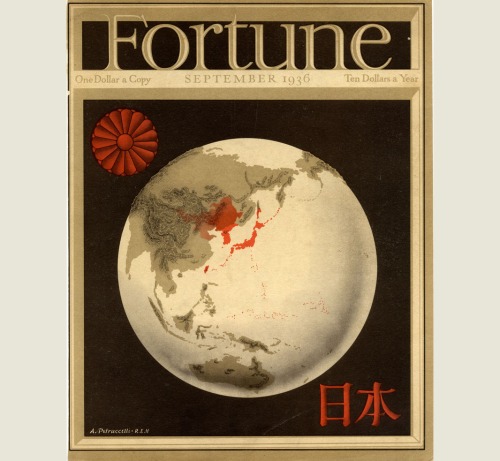
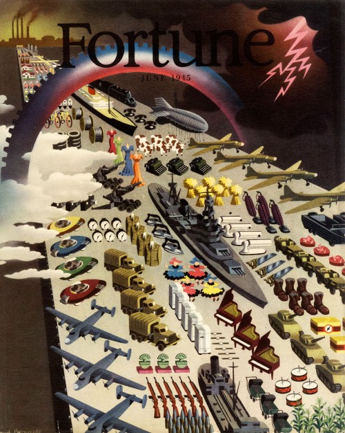
Antonio Petrucelli’s name is probably unfamiliar to map people, although it shouldn’t be. Petrucelli was one of the artists whose work was commonly found on the cover (and inside) Fortune magazine from the 1930s through the 1950s. Petrucelli collaborated with Richard Edes Harrison and was a contemporary of Boris Artzybasheff. Like Edes Harrison and Artzybasheff, Petrucelli had an interest in and proclivity for maps. This is evident in the cover (below) from the September 1936 issue of Fortune, created by Petrucelli and Edes Harrison. “This was a collaboration with Ricky Harrison, who did the basic map projection and I the final art.” (source)

petrucelli_fortune_cover_w-harrison

The best source for information on Petrucelli and his work is the very cool but very confusingly organized series of pages at Chris Mullen’s Fulltable.com site. Mullen visited and interviewed Petrucelli in the early 1980s. Petrucelli died in 1994.

petrucelli_fortune_cover

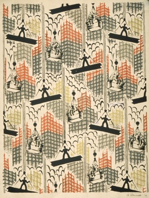
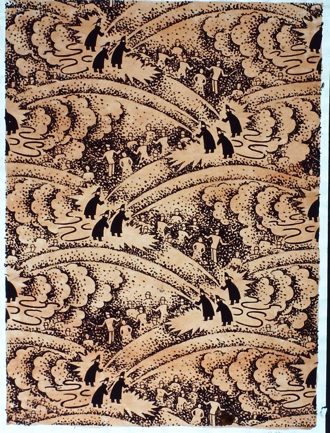
Petrucelli was a textile designer in the 1920s and early 1930s (for Cheney Brothers), eventually ending up in pajama design. In 1932 the Art Alliance of America awarded Petrucelli first prize (in textile design) for a series of urban geography pajama designs (below), including men building skyscrapers, tugboats, and firemen spraying hoses.

petrucelli_cloth1

My beautiful picture

My beautiful picture

Map-inspired designs for pajama cloth, 1932

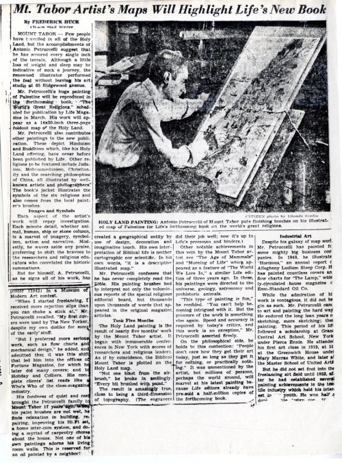
An undated but ca. 1957 article from the Citizen newspaper (New Jersey) shows Petrucelli working on a map of Palestine, which appeared in the Life Magazine book The World’s Great Religions (1957).

sh494

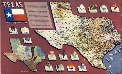
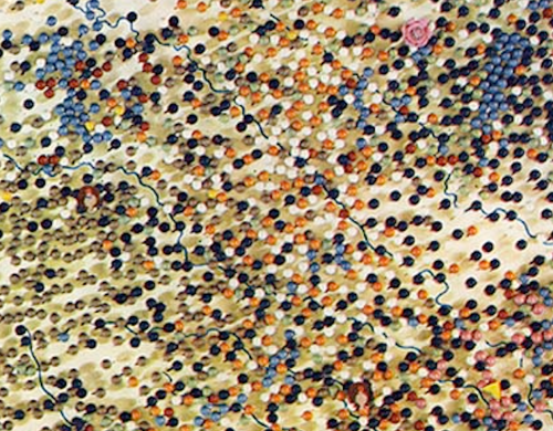
A map of Texas appeared in Fortune in December of 1939: This was a dot map made of map pins stuck into the map, then photographed. This raises the specter of map pins and pinnage (and a Bit More on Map Pins)!

“On a map of Texas 1939, a paper paste-up perspective, I used some hundreds of coloured map pins to locate resources, industries etc. I worked from a mass of detailed data, enough for a dozen Texases, with statistically minded researchers. The result was a colourful but confusing jumble. The girls volunteered to remove and arrange the clusters of pins if I would let them. Sure, I think they had more fun than I would have done – for them a departure into new pastures. If you look closely some pin holes are visible in the repro.” (source)

Screen Shot 2019-02-07 at 12.06.19 PM.png

petrucelli_texas

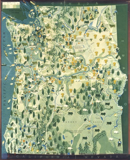
On the theme of U.S. states, an even grander map of Washington and Oregon, in four sections, published in Fortune in March of 1940. The pictorial style is reminiscent of the work of Erwin Raisz, such as the maps used in his Atlas de Cuba (1949). Three insets are below, then the entire map.

Screen Shot 2019-02-07 at 11.13.49 AM

Screen Shot 2019-02-07 at 11.14.22 AM

Screen Shot 2019-02-07 at 11.14.06 AM

…and the entire map (four sections together; they don’t quite match!):

petrucelli_washingtonoregon

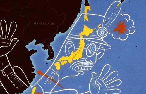
A typically racist WW2 propaganda map, undated and I believe unpublished, is included in the Fulltable.com archive of Petrucelli’s manuscript work. A closeup, then the entire map follows:

Screen Shot 2019-02-07 at 11.24.36 AM

My beautiful picture

A map of New Guinea appeared in the May 1945 issue of Fortune. One close-up is below then the entire two-page spread map follows.

Screen Shot 2019-02-07 at 11.26.34 AM

petrucelli_new_guinea

A map of the Congo River and its region, from the November 1952 issue of Fortune.

petrucelli_congo

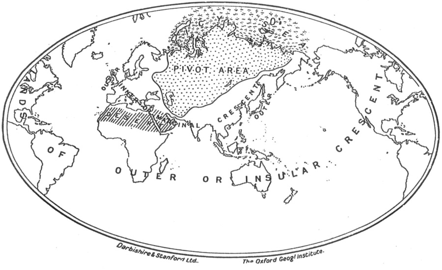
Heartland“The Earth According to Haushofer, Geopolitician Extraordinary and Prophet of Nazi Domination” published in Fortune, November 1941. The text below this map indicates that it is azimuthal map projection, upon which Sir Halford Mackinder’s map of lebensraum (right) is transferred.

“The Mackinder map… fails to illustrate the roundness of the earth. Above is the Mackinder map on an azimuthal projection, centered near the ‘pivot area.’ This provides the ’roundness,’ but is subject to extreme distortion at the periphery… The azimuthal map also shows that the ‘outer crescent’ is not a crescent at all. Its tips meet, forming a ring – welded where? In North America.”

petrucelli_geopolitical

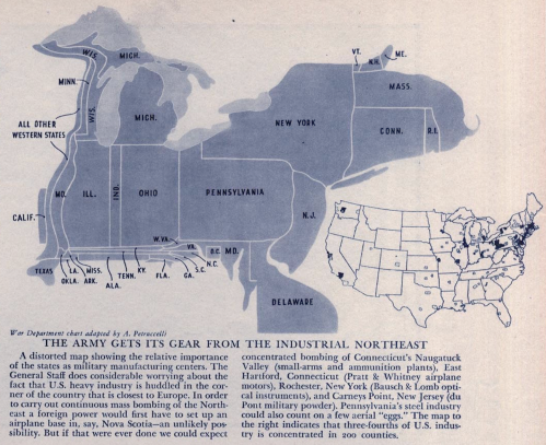
Finally, a cartogram of U.S. Army supply sources that accompanies an article called The Industrial Northeast” in Fortune (undated, included at Fulltable.com on this page).

Screen Shot 2019-02-07 at 12.01.19 PM

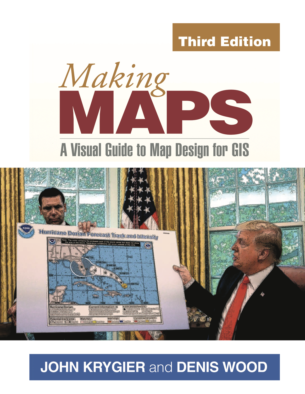
Making Maps is Great!

mm_trumpcover

tumblr_nbwxfcQ9jZ1tga8o1o1_1280


Review by Denis Wood of
Katherine Marsh. Nowhere Boy (Roaring Brook, New York, 2018)
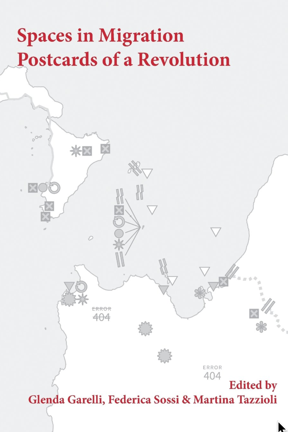
Glenda Garelli, Federica Sossi & Martina Tazzioli. Spaces in Migration: Postcards of a Revolution (Pavement Books, London, 2013).
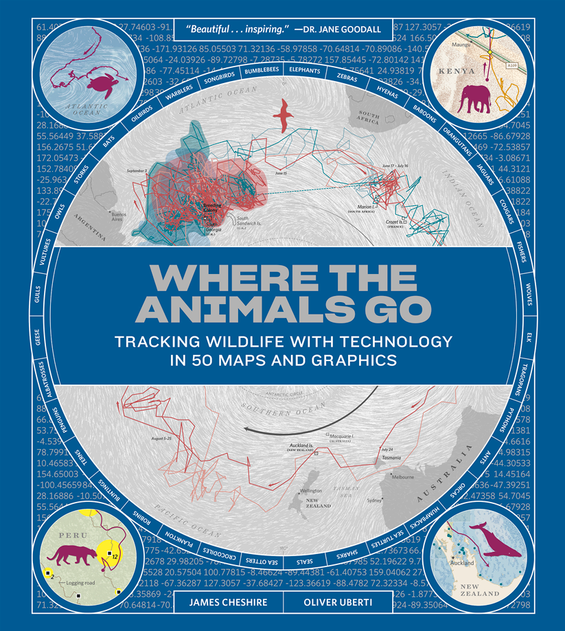
James Cheshire and Oliver Uberti. Where the Animals Go: Tracking Wildlife with Technology in 50 Maps and Graphics (Norton, New York, 2017)


Where? Nowhere

One of them doesn’t exist.

What could that mean, doesn’t exist? Clearly he exists. He has flesh. He has bones. What he doesn’t have are … papers. Which is another way of saying … any rights. No rights. This is to say that spatially he has no right to exist where he does. Where he does? What could that possibly mean? Where else except where he is could he exist?

Well, nowhere, obviously. So this must mean something else. But it’s hard to say what. The boy we’re talking about is Syrian, which is to say that he was born in Syria and until recently lived there. Now he’s in Brussels, in the corner of a basement in a house whose other inhabitants don’t know he’s there. He comes out at night to filch a little food but is very quiet because if they knew he was there they’d turn him over to the authorities who would lock him up. Or send him back to Syria which he’d fled because of the war there. He had the right to be in Syria, but no way to be in Syria. He has a way to be in Brussels, but no right to be there.

Rights don’t seem to be very strongly connected to the way things are, to the actual state of things.

Rights are permissions granted to people by others. To say that the boy – his name is Ahmed – had no right to exist in Brussels is to say that those around him hadn’t given him permission to exist there. Well, this isn’t quite right either. Max had. Max was another boy living in the house, one who did exist, who did have a right to be there. A partial right. His family had moved there from Washington when his father was posted to Brussels. Max finds, he ferrets out Ahmed in the basement. The two become friends and Max abets Ahmed’s secret life in the house.

Fig 1 Nowhere Boy cover

The boys are characters in Katherine Marsh’s Nowhere Boy (Roaring Brook, New York, 2018), a young adult novel about the refugees coming to Europe, these days through the desert and across the seas. Those fleeing to Europe are fleeing war and destitution and tend to be Muslim, which is pretty stigmatized in Europe. These people are not wanted, even in countries that desperately need their labor, like Hungary. Ironically Ahmed and Max end up in Hungary, in Kiskunhalas, near its border with Serbia, where Ahmed’s father is in detention. It’s a young adult novel, so it ends well. But until it does, Ahmed “didn’t want to go anywhere anymore. He felt safer being nowhere.”

Which is what not existing means: it means being nowhere.

Being nowhere means you can’t be plotted to a map. Not existing, being nowhere, and being unmappable are all vaguely synonymous. Of course they’re abstractions. One flesh and blood body can annihilate them all. Which is what Ahmed’s body did, violated the abstractions, rendering him existent, there, and mappable. This is also what the Tunisians from Lampedusa in Paris did when they occupied 51 Avenue Simon Bolivar, hanging out a banner that read, “Ni police, ni charité. Un lieu pour s’organiser.” Which is to say, “No police, no charity. A place where we can organize.” A place. They wanted a place which, nowhere, nonexistent and unmappable, they didn’t, they couldn’t have. What they had, two days later, were police, plenty of them, who forced them back onto the streets and so rendered them, once more, nonexistent, nowhere, and unmappable.

Fig 2 Spaces in Migration cover

These were the harraga, “those who burn.” Meaning both “young people who ‘burn’ frontiers as they migrate across the Mediterranean sea and those who are ready to burn their documents (but also their pasts and eventually their lives).” The words are those of Paola Gandolfi from her “Spaces in Migration” in Glenda Garelli, Federica Sossi and Martina Tazzioli’s Spaces in Migration: Postcards of a Revolution (Pavement Books, London, 2013). “Spaces in migration” is an ambiguous phrase, implying both spaces moving in the process of migration (for example, the spaces moving with the migrants’ bodies) but also the spaces emerging in the process of migration (like 51 Avenue Simon Bolivar, like the detention facilities on Lampedusa). Either, or both of these taken along with the burning of frontiers and the burning of documents can melt the solidities, the certainties, of the contemporary system of nation-states.

Which are, after all, bounded places (states) with a population that is more or less culturally coherent (nations). There may be no true nation-states these days, given the bewildering range of peoples that live in even the smallest of them (Abkhazia, for example), but there are states galore, with ever more jealously guarded borders.

When these are “burned” by harraga it’s as though a body were being wounded, anything might get in, there would be no integrity, the body could come apart. So when the Tunisians started crossing the Mediterranean for France and reached Lampedusa, a minute island midway between Sfax, in Tunisia, and Malta, from which, thanks to a permit granted by the Italians, they were able to travel freely through the Schengen Area, you’d think the whole African continent was attempting to pour into Europe. The few thousand who initially reached Lampedusa, well, Lampedusa is small. It’s not eight square miles. But still, the first few thousands that arrived immediately aroused a language of Biblical proportions, of natural disasters: plagues, floods, tsunamis, simply overwhelming numbers which, in fact, didn’t amount to single thousandth of a single percent of the even the Italian population. Even in August when the number did reach fifty thousand it was still inconceivably small.

You’d think a dagger was being driven into the Italian, into the French heart.

The French closed its border with Italy. There was no way they were letting all these Tunisians into la patrie, despite their own earlier colonization of Tunisia. The French into Tunisia? Certainly. (And they didn’t give it up until 1956). But Tunisians into France? Unthinkable! To say nothing of the Libyans, who with their numbers soon revealed how few the Tunisians had been, the Eritreans, the Senegalese, the Syrians … All barely existent nowhere people on the move …

Fig 3 Spaces in Migration MAP

The map here may confuse some people. For one thing, north is to the left of the map. For another we’re not used to seeing this piece of the Mediterranean, turned this way, at this scale. Tunisia is in the lower right. That’s Libya above it. Lampedusa is the dot from which the items labeled 9 and 10, among others, are emanating. Paris is indicated by 12. Be that as it may, it’s astonishing how tight everything is, how close, how these two continents so firmly separated by Mohammed and Charlemagne almost kiss, even here in the middle of the sea. Lampedusa has kin, Linosa and Lampione. You can even see Tunisia from Pantelleria (it’s only 37 miles away). Despite this the rhetorical distance separating Europe and Africa remains all but uncrossable.

For the undocumented burning their way across it is crossable, but only as long as they remain nonexistent, nowhere, and unmappable. The problem is, “You start to get hungry, you smell and you only have one pair of jeans to wear. You never take your shoes off and your feet hurt. You call home, not too often, to let them know you are still alive but you do not speak of your insistence on space, and sometimes you start to think about returning. You even go as far as to insist on consulate offices to try to work out how to get home. But you burnt a border when you left on a boat, one that won’t allow you to burn it again on the return journey.” This comes from Garelli, Sossi, and Tazzioli’s “Postcards of a Revolution,” the conclusion to their book (it’s also online here). This is as close as you can get to despairing without actually giving up.

Fig 4 where the animals go cover

Placeless: often this is to say on the move, and since in motion, unmappable, wherever they may happen to be. It’s hard to map things in motion. All the ways we’ve developed are workarounds. Some of the best of these are captured in the recent book, Where the Animals Go: Tracking Wildlife with Technology in 50 Maps and Graphics (Norton, New York, 2017) by James Cheshire and Oliver Uberti. Like Ahmed in Brussels, like the Tunisians in Paris, animals too are undocumented, and like Ahmed and the Tunisians they too burn borders without hesitation. If they’re even aware of them.

Select maps from our new book, Where The Animals Go

Take Slavc, a young wolf from the mountains on the Croatian-Slovenian border. He left his maternal pack and struck out on his own, crossing motorways and major rivers, navigating the Dolomites in the middle of winter and the suburbs of Verona; moving from the Dinaric Alps, across the Drava into the Alps, and so from Slovenia into Austria, and into and through the Dolomites, which is to say into Italy, before settling in the upper plateau of Monte Lessini. Slavc leaves Croatia, crosses Slovenia and Austria, and slips into Italy, all without so much as a by-your-leave from a single border agent. Of course he’s not a human so … who cares?

That he’s visible at all is because he’d been radio collared by a University of Ljubljana conservationist who tracked his GPS transmissions. The collar sent about seven locations a day, allowing Hubert Potočnik to interpolate the rest of Slavc’s movements. Mostly he moved at night, more like Ahmed than the Tunisians. He didn’t kill a domestic animal until he reached the outskirts of Verona, so if he hadn’t been radio collared he would have been completely invisible.

The carnivore at the top of the food chain is less easily hidden and, when seen, needs to be able to exhibit papers. The simmering European refugee “crisis” has led to an armoring of border and after border, including the one in the Dinarics that Slavc crossed between Croatia and Slovenia. The Dinarics are home to many animals that now move freely across the Slovenian and Croatian border, wolves, obviously, but also, among the collared, lynx and bears. The borders that impede the movement of Syrians and Eritreans also impede and usually preclude the movement of all the larger mammals. Impenetrable barriers are horrifying intrusions into their lives and genetically disastrous.

But what is this terror of the mobile? Only that it implies the fragility of the police states into which most modern states have evolved. Is there any that lacks its apparatus of control, its mechanisms for identifying, tracking, apprehending and expelling any it stigmatizes as unwelcome? It has less success with wolves, with storks, with whales but only because, inhuman, they’re less subject to scrutiny. As we have seen this has its downside: unintended control by barriers meant for humans. How many animals moving back and forth across the US-Mexico border will be trapped on one side or the other by Trump’s wall? How many will have their ranges severed? How many will be separated from their families?

I think it’s easy enough to answer, “Enough, enough will be separated from their families,” just as Ahmed was separated from his, as the Tunisians were separated from theirs, as animals around the world are separated from theirs.

Why do we even care where any of these are?

Isn’t it enough to know where we are? And when you stop to think about it, isn’t that hard enough?

screen shot 2019-01-30 at 10.30.35 am

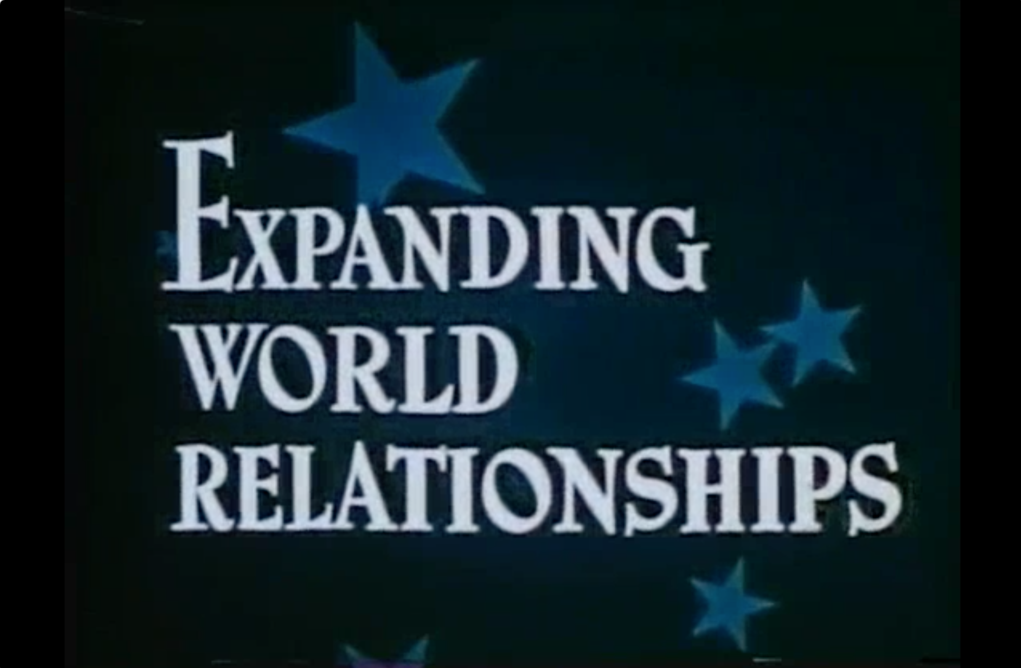
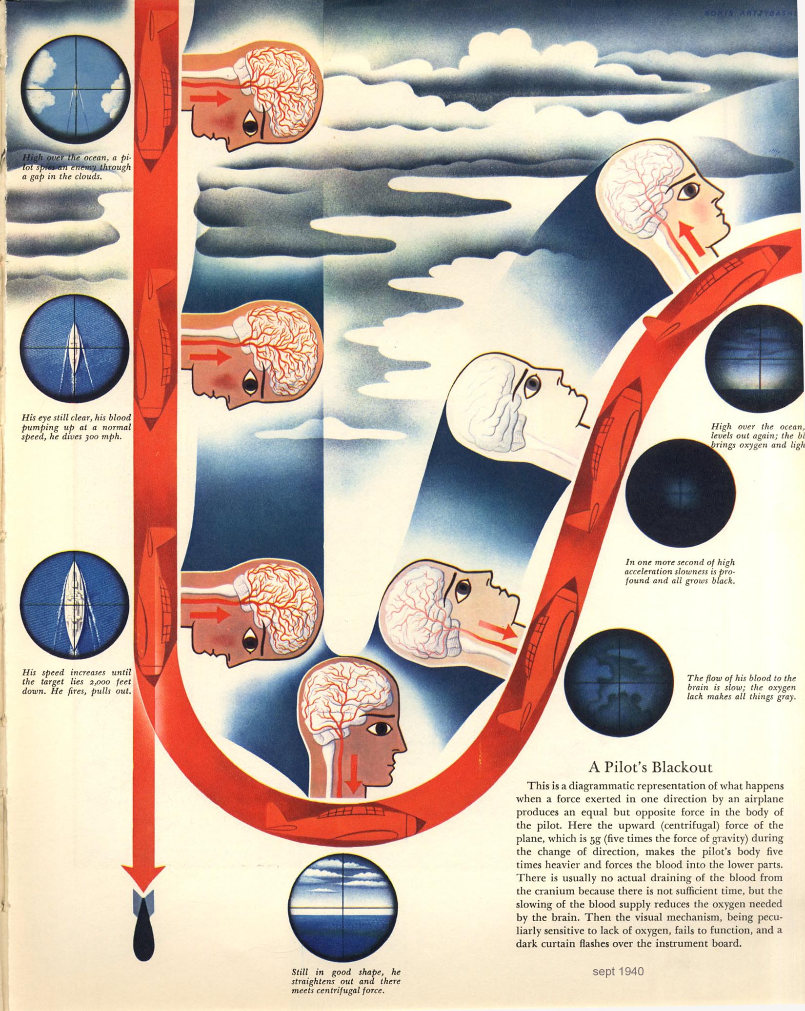
In doing research for the post on Boris Artzybasheff’s Maps I came across mention of a movie – Expanding World Relationships – created by State Department Geographer S.W. Boggs. Boggs allegedly used Artzybasheff as a consultant. This old map movie also relates to Matt Wilson’s book New Lines, where he goes into maps, movement, and cinema.

Timothy Barney’s book Mapping the Cold War (2015), using quotes from manuscript sources, suggests that Artzybasheff and Boggs had discussed using creative map animations with aliens for the movie (see quotes at the end of this posting).

I’m all for maps and aliens.

I could not find Expanding World Relationships anywhere on the internets. If the movie actually had Artzybasheff aliens and maps it would be a great find. I eventually found a copy of the movie in an archive of old public domain movies.

screen shot 2019-01-30 at 10.15.27 am

Unfortunately, no aliens and no Artzybasheff. Dammit.

What we do have is a 10 minute animated movie (clips and full movie embedded below) that captures S.W. Boggs’ cold war global vision. Too bad he couldn’t get Artzybasheff or Edes Harrison to create the artwork. My guess, these top-shelf illustrators were too expensive compared to the hack animators who ended up creating the movie.

The cheesy music and wobbly frames add authentic patina to what is actually a good example of a mid-century animated map movie. Importantly, there are various data (“thematic”) maps in the movie – of telecommunications, resources, economic factors – not just the typical armies marching around and ships sailing across the ocean (although there are some of those).

My favorite is an animation of building a “doomed to fail” wall – in this case, tariffs. But the clip has some relevance to contemporary issues:

An animated telephone handset map (a still opens this post) is another minor gem, suggesting that growing telecommunications are bringing the world closer together:

An animated map comparing different forms of transportation, and their increasingly global reach, uses a curved bar graph animation to make its point:

Finally, a projected map shows insets (a bit difficult to discern) of graduated symbol maps, showing industrial growth in different parts of the world along with resource development (rubber, tin, tungsten, cobalt, chromium):

Here is the entire movie for your perusal:

Expanding World Relationships (1947) from John Krygier on Vimeo.


The quotes below are from Timothy Barney, (Re)Placing America: Cold War Mapping And The Mediation Of International Space, Dissertation, University of Maryland, 2011. Direct PDF download here. Published as Mapping the Cold War: Cartography and the Framing of America’s International Power, 2015.

“Another example of Boggs reaching beyond traditional conceptions of geography was in his work for an animated educational film, for which he served as consultant and for which he also recruited Artzybasheff. The 1947 film, entitled Expanding World Relationships, was produced through Springer Pictures, and was later distributed internationally through the United States Information Agency. The picture is a fascinating mid-century textual artifact designed to grapple with the new global relations of the United States in a changed post-war landscape, and emphasizing the role of perspective itself. In one production memorandum to Artzybasheff, for example, Boggs expresses his thought process in designing an appropriate air-age global perspective for educational objectives. Boggs proposes that Artzybasheff design for the film a series of scenes where aliens approach the earth from a rocket ship, gaining a ‘bird’s eye view’ of the earth as they descend toward it. What the aliens find when they explore earth is a ‘strong indication that man may not have sense enough to organize his affairs’ and ‘they end up with a very factual, realistic picture of the world as it is, especially as the relations between peoples in different parts of the world…have changed very unequally.’ Boggs goes on to talk about the benefits of using this alien perspective to ‘attract the interest of anybody’ and to show how humans must gain a better bird’s-eye view and knowledge of the earth before they commit ‘racial suicide.’ Here we see the brand of idealism behind Boggs’ approach—that better spatial knowledge can somehow ‘save’ us.” (Barney, 2011, p. 189-191)

imageWhy don’t you get a copy of Matthew Wilson’s book New Lines (University of Minnesota Press, 2017). The paperback isn’t very expensive. Grab a pencil and take notes in the margins as you read. Skip stuff that does not seem that interesting. And write down ideas as you read.

I know some of the folks who follow this blog aren’t academics, and even if they are, they may not be into contemporary critical theory. New Lines isn’t perfect. But it does take maps very seriously. That’s important for people who are following this blog because there is something about maps that… well, there’s just something about them. Otherwise, you wouldn’t be here.

You can find Matt and his info on the web here.

•••••••

I think you should read Matt’s book, even if you don’t think it’s your thing. Your time would be better spent reading New Lines than reading what I wrote below –  notes and reactions rather than a review. Stuff that blipped in my mind as I read New Lines, with some reactions and elaborations.

•••••••

New Lines is proposed to be a “manifesto for a revival of Critical GIS mapping practice” (23-24).

•••••••

I’ll start where I end this (long) posting:

Maybe it’s about making maps, period. And providing the kind of ideas and motivations that get more people making more interesting and impactful and creative maps. Any resource, guide, book, article, class, talk, or manifesto will be judged by its ability to inspire just that.

•••••••

I just attended a meeting in Atlanta called CommGeog19 – “the first national workshop on community geography” (January 25-26 2019, web stuff is here). It was a great meeting, small, diverse, very interactive and all about an emerging field that builds on many ideas I’ve been engaged with over the last several decades. Many of those ideas are woven through Matt Wilson’s New Lines, which was the specific impetus for reading the book.

That meeting was full of people committed to critical GIS mapping practice.

•••••••

Let me first say that the critical approaches reviewed and propelled forward in New Lines are the impetus for the Making Maps book and this blog. While it may not seem as if Making Maps is a critical cartography (or GIS) book, it is. Maybe without all the words and jargon and scribble scribble scribble.

The academic sub-fields of Critical Cartography and Critical GIS have direct roots in the 1980s and 1990s when academics such as Brian Harley (“Deconstructing the Map“) and Denis Wood (The Power of Maps) distilled ideas from a range of continental philosophy (and other traditions, such as pragmatism) and aimed it at the things we call maps, the people who create them (“cartographers”) and technologies such as Geographic Information Systems (GIS). The critical interrogation of maps goes back earlier than the 1980s, a theme explored in an article (“An Introduction to Critical Cartography“) Jeremy Crampton and I wrote in 2010. An important touchstone for Critical GIS is Nadine Schuurman’s dissertation Critical GIS: Theorizing an Emerging Science published in the journal Cartographica (36:4, pp. 7-108).

An unruly flock of related ideas and approaches surround these critical themes, including qualitative GIS, participatory GIS (PPGIS and PGIS), citizen GIScience, feminist GIS, digital humanities, cartographic and GIS ethics, geohumanities, the geoweb, neogeography, community GIS, mapping and community geography, psychogeography, public scholarship… among others. These are theories, concepts, approaches, technologies, cross-disciplinary areas of study and interesting things that people do that, in many cases, have embedded mapping practices.

Many mapping and GIS folks find these approaches to be too academic, to jargon-laden, too distant from the practical and useful. That’s too bad because to paraphrase Matt Wilson in his book New Lines: Critical GIS and the Trouble of the Map, all these critical approaches share one important commonality: they take maps very seriously.

I thank Wilson for this point: all these critical approaches are appealing to me because I’ve never found maps to be simple, easy, uncomplicated. From the start, when I started making maps in the Cartographic Lab at UW-Madison back in the 1980s, it was clear that there was much more going on than what was written down in a textbook like Robinson’s Elements of Cartography. That Brian and Denis and other folks started writing all this crazy stuff just around the time I was deeply engaged in making actual maps was very opportune. They saw something really important in maps and mapping. The traditional world of map making and the critical world swirled around and together into, well, stuff like this blog and the Making Maps book.

•••••••

Below find quotes and bits from New Lines with my reflections and thoughts (all part of my preparation for forthcoming projects).

•••••••

Habits (xi). Habits and the habitual are part of mapping to an excessive degree. To what extent is it possible and important to break habits (the rules of making maps)? The Making Maps book highlights habits (good habits? Ok habits? Bad habits?) but tries to work in all sorts of anti-habitual cues. The unMaking Maps project is even more focused on anti-habitual practices.

Representation (3). I’m curious about the continued reliance on what seems to be basic representational thinking. See Denis and my comic on this fun topic, published in Rethinking Maps (edited by Martin Dodge, Rob Kitchin, and Chris Perkins; Routledge 2009), as chapter 11: Ce n’est pas le Monde [This is not the world]. There’s a PDF at my blog posting about the Rethinking Maps book. Denis Wood and John Fels The Natures of Maps interrogates the idea of maps as propositions in a much more substantive manner. Non-representational concepts (such as propositions) seem to get at some of the other things Matt Wilson ponders in New Lines ch. 4 (“Attention”) when he quotes Arthur Robinson on maps and advertising. If we look at maps as a kind of advertising (“the act or practice of calling public attention to one’s product, service, need, etc…”) then thinking about maps as propositions might work better than thinking about maps as representations. That’s not to say you can’t think of them as both representational and propositional (and more).

“Critical GIS requires practice.” (9): This should make mapping and GIS practitioners happy. Take maps seriously by taking practice seriously. But not just how to use ArcGIS or fine-tune colors in Adobe Illustrator. The idea of practice is embedded in modern cartography and GIS from simplistic debates about the alleged utilitarian vs conceptual approaches to mapping and GIS through ontological arguments growing out of pragmatic approaches. (I wrote about one take on these ideas a long time ago as “The Praxis of Public Participation GIS and Visualization.” In Community Participation and Geographic Information Systems, 2002).

On habit vs. practice: Someone needs to write something on this…

“Critical GIS is always a doing and an undoing” … a “…productive schizophrenia…” (10). More than doing (habit, practice?) one needs to undo. Again, I think of the goals of the unMaking Maps project (which may be aimed at breaking the representational mirage of maps) but also issues about specific strategies of undoing, non-habits, counter-practice, etc. Certainly, “critical thinking” but are there more specific forms of “productive schizophrenia” that can be compiled? Could these be used by non-academic map practitioners?

Monsters (13): Maybe not exactly as Wilson intends, but a compilation of map monsters would be pleasant to see. Actually, this blog has more than its share. The word monster is from Latin monstrum “divine omen, portent, sign; abnormal shape; monster, monstrosity,” figuratively “repulsive character, object of dread, awful deed, abomination,” from root of monere “to admonish, warn, advice,” from PIE *moneyo-, suffixed (causative) form of root *men- (1) “to think.” (source).

“The map as an event, a kind of aporia, a difficulty, a perplexity.” (13) Aporia! I’m thinking we need the world maporia: spatial expressions that are “impassable” and “inclined to doubt;” leading to “a perplexity or difficulty.”

Experiments & experimentation (14). The Robinsonian approach (which expanded from the perceptual to the behavioral and cognitive, but all drawing core methods from psychology) was experimental. The idea of experiments and experimentation can be much broader. It comes up in psychogeography all the time. Remember that maps used to be (and sometimes are still) made in “cartographic laboratories.” Maps are “experiments with territories.

Compelling, maps as (16-17). If maps compel do they have agency?

Psychogeography (27). The point of Debord’s psychogeography “was to resist actions made habit through the relationship with the map.” We are back to habits, and breaking them. With its strong focus on practice and experimenting (and undoing), psychogeography seems to be a fundamentally important approach to the kind of critical GIS mapping practice Wilson is calling for. Yet psychogeography gets a relatively short treatment in New Lines. See “Lynch Debord: About Two Psychogeographies” (Denis Wood, 2010).

“Wild” Bill Bunge (27). Bunge too, with his Fitzgerald: Geography of a Revolution is a central figure in the critical GIS mapping firmament (although much of his work came before computer GIS was a thing): the practice of mapping with a firm critique of both the economy and the academy. A complicated person with a complicated legacy. He used to stop by once in a while to talk to us grad students at UW-Madison, setting the faculty aflutter. Let’s just say Bunge is another exemplar of the kind of work Wilson wants to see more of as part of a critical GIS mapping.

Origin stories (31). “The research agenda for critical GIS has never been broader. It has also remained largely unchanged since its earlier incarnation at the Initiative 19 meetings in 1996.” Rina Ghose (here on ResearchGate) made a similar point at the CommGeog19 meeting last week. I do have the feeling that many of the key ideas and hopes for critical GIS and mapping have not been realized. But I’m not sure anyone was ever particularly clear about what exactly these fields were supposed to accomplish. This just popped up on ResearchGate: “Rethinking PGIS: Participatory or (Post)Political GIS?”

Origin stories (31). Missing from the list is Denis Wood. Another complicated person. But it’s hard to deny the impact that his book The Power of Maps had on the way we think about maps and mapping, especially outside of academic Geography. His publications in the 1980s and early 1990s really rattled cages. I recall a graduate seminar at UW-Madison on the history of cartography. Denis’s work rattled rankled and caught the attention of both David Woodward (who taught the seminar) and Brian Harley (who attended some meetings). The point: Denis was someone taking maps very seriously, but at a trajectory that often seemed to be perpendicular to that of David and Brian. Critical cartography (and GIS) is not a monoculture! I can’t overstate how exciting that specific time and place was. I captured some of these experiences in “Reflections on J.B. Harley’s ‘‘Deconstructing the Map’’ (2015)

Maps and staging (33): “How does the map stage?” Cinematic or theatrical metaphors. Hints to the later discussion of cinema and maps/GIS.

“My hope for qualitative GIS.” (37): A mixed media artwork by Enrique Chagoya is casually offered up as Wilson’s hope for qualitative GIS. Ok! What is it, reverse modernism? A critique of cultural appropriation? While intriguing, it feels like this kind of hope does not offer much hope. It ends up as an exemplar with no path (besides complete departure) from current, normative mapping practices. The same for the issue of maps as cinema raised later. What does mapping and GIS practice, shaped by all these exemplars (and many decades of theoretical writings), look like? It’s sort of like saying there’s a real problem with income inequality in the U.S. then showing a picture of a fish as the goal, the hope. Wtf?

dsc00293

Richard Edes Harrison (44): Edes Harrison seems to be a hero in New Lines. That’s ok! But his role in the creative mapping during and after WW2 is more complicated than presented. Shaping Edes Harrison’s vision was S.W. Boggs, the U.S. Department of State’s official geographer (1927-1954). Boggs enlisted the help of Harrison and other artists to create global visualizations he apparently could not get from traditional mapmakers. I touch on some of this in a recent posting on Boris Artzybasheff’s Maps. “Boggs was responsible for initiating partnerships between artists such as Artzybasheff and the State Department for technical cartographic advice and map production, but in the process absorbed an appreciation of these artists’ global visualization and their sense of the larger American public.” (Barney, 2011, p. 186). I think this era produced numerous exemplars of the kind of disruptive, new mapping Wilson wants to see. Yet at the same time, these efforts were a political vision of American dominance, economic globalization, produced by artists who themselves were largely funded through creating advertising for global capital. Yikes! We shouldn’t be naive about disruptive, new cartographies. Finally, Edes Harrison’s famed global visualizations were, from one perspective, just drawings of a globe from different perspectives! There, I said it. (See Timothy Barney’s Mapping the Cold War [2015] and the dissertation it was based on: (Re)Placing America: Cold War Mapping And The Mediation Of International Space, Dissertation, University of Maryland, 2011. Direct PDF download here). This cool article also: “Richard Edes Harrison and the Cartographic Perspective of Modern Internationalism.”

“Certainly, then and now, the drawing of a line is the making of a difference.” (44=45). As with other chapters in New Lines, this one drops a bunch of interesting ideas in a few paragraphs at the end.

“…the gloss, or patina, of contemporary geovisualizations, made with advanced geospatial and illustration software, can risk breaking with a key commitment of early to mid-twentieth-century geographic representations: a commitment to the wide participation of a map-reading audience in the reading and wonder of the world.” 

Ok, I’m hearing Wilson channel Harley back in the day. Then it was good old paper maps (typically topographic maps), public, accessible, engendering wonder being replaced by GIS and computer mapping software that was restrictive and too flashy. Harley didn’t like email either. Called it evil-mail. A whiff of the nostalgic.

“How might design resist the gloss of spectacle and elevate slow-mapping, where the representation intervenes in the known? How might the fine adjustments made in geospatial and illustration software further disguise the mechanics of representation from a public? How might cartographic experimentation forgo the rush toward a faddish polishing of infographics and instead amplify the disruptive potential of geographic representation?”

I believe the reference here is maps like those made by Edes Harrison and Raisz. The “fine adjustments” comes across as the reaction one might have in attending a session at a NACIS conference. Talk about fine people into fine adjustments! But Edes Harrison et al. were all about fine adjustments too. They were master graphic designers. Like the NACIS folks. I’m left wanting something here… more examples (not just Edes Harrison) of the disruptive, but also examples that are not postcolonial paintings or art movies.

Digitality (47-). I enjoyed the discussion of Howard Fisher and the Harvard Laboratory for Computer Graphics. This is, of course, one of the origins of ESRI (which dominates mainstream mapping and GIS, along with Google). This story was documented in an ESRI Press book by Nick Chrisman, Charting the Unknown: How Computer Mapping at Harvard Became GIS (2006) which Wilson does not cite. I have not read Charting the Unknown. Maybe it’s too much of a hagiography. But this chapter seems also to be a bit hagiographic. Although I like the concept of Howard Fisher.

Regarding the emerging computer technology in the 1960s: “Fisher was disinterested in the routine utility of these systems, but interested in how they might be pushed to do something not yet imagined, how to use and abuse these techniques in service of something more disruptive.” (50). And I get that. But what I can’t shake is the sense that Fisher and the other folks in this story (hard workers all!) largely replicated the most fundamental, conservative, and functional aspects of cartography in this new digital world. Points, lines, areas! Overlay analysis! Codification of quantitative geography! Symbolization (first typewriter approximations but later the standardized symbols used in analog cartography). Nothing new there. Digital mapping also excluded the artisanal mapping (just praised in the previous chapter of New Lines) produced by Edes Harrison and Erwin Raisz (who was at Harvard at the time). I know, I know… think about what was to come. But wait, what was coming was military-industrial GIS, glossy geovisualization, etc. Those trajectories don’t end up in a very favorable place in New Lines either. I guess I need more evidence that Fisher was questioning much at all about 1960s cartography; mostly it seems he was trying to figure out how to make computers do maps as defined by a very non-radical, non-disruptive cartography.

“All maps are a con.” (61) This is a cool quote from Fisher. Wilson follows: “Fisher understood that the computer disrupted the relationship between the author of the map and the reader, a relationship that had always been based largely on deception.” It’s probably true that early computer maps did cause disruptions.

symap

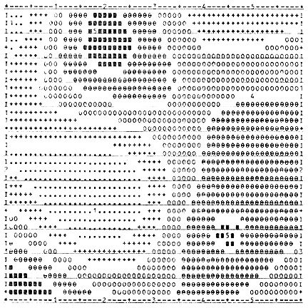
Harvard Graphics Lab SYMAP map ca., 1965. More or less a typewriter map.

The look of these maps was weird, and it led the viewer to notice the form of the map, rather than the content. That’s one of the things you teach in map design. Get the viewer into the content, not the form. If the colors are wonky, or hard to distinguish, or the type is too small, the viewer notices the design and not the content (and that isn’t good). Thus “bad maps” are disruptive.

I’m not sure how to sort this out: these early computer maps were disruptive and drew attention to the fact that the maps were authored (not just magic images of the real world). Wilson goes on to quote Fisher some more: “The goal of mapping is understanding, not maps.” That is, more or less, the beacon of modern cartography (at least since WW2).

Movement (69-). This chapter gets close to my world, as it was, at Penn State back in the early 2000s. What was abuzz was geographic visualization, inspired by scientific visualization, itself spurred by advances in computers. Animated maps were central to this “new paradigm.” The origins in scientific visualization, or SciViz, are important (but not really discussed in New Lines).

“The rise of GIScience can be understood, from one perspective, as an elaboration on centuries of practice to capture time, to render time immobile, in order to fix (ate on) spatiality.” (72).

Sure. And the mantra ca. 2000 was to harness new computer technology and its ability to map time to time. Rather than time to space. Animated maps were disruptive, although possibly more novelty than disruption. Keep in mind that humans are evolutionarily hardwired to notice movement (one of the Four Arguments for the Elimination of Television). Keep in mind that animated maps were not new (they could be found prior to pre-WW2). Keep in mind that the emerging WWW had all sorts of moving stuff. In the big scheme of things, I’m not sure movement and maps were (or are) that big of a deal.

But it was a time of great map experimentation. And that is important to note.

Wilson sets up a binary here where objective, Robinsonian cartography is contrasted with “subjective” aspects of mapping, including “harmony, movement, balance, and proportion.” Robinson is open to these… but what does he (and a neo-Robinsonian bevy of cartographers) do with such unruly subjects? These are components of interest, says Wilson, to critical geography.

Are we, then, linking maps to theories?

“I recall an economist once telling me that the map was a theory which geographers had accepted.” (Ullman, 1953 p. 57)

As there are different geographic theories, then there can be different kinds of corresponding maps. And we can experiment with new maps, based on new theories. Or maybe theories that don’t typically serve as the foundation for maps.

The problem is when “more resolved cartographers … attempt to pin down these more slippery elements. Herein lies the trouble.” (77) Who is supposed to pin down slippery elements?

Wilson does not like attempts by mainstream cartography to operationalize what he sees as subjective components (harmony, movement, etc.). It is too reductionist, too close to standard mapping practice, too devoid of human, subjective experiences. “We need further conceptual development to take up those more subjective elements of cartography, which cause readers to gaze unendingly at the moving spatial representation in front of them.” (80)

So what is the “further conceptual development”? One answer is cinema. And there are some interesting discussions in this part of the book. But I do think some of the early work on map animation gets short shrift. In other words, before we move on to making movies, don’t dismiss the work that went on with animated and dynamic maps in the early 2000s.

I still think Wilson wants cinema. But his subject is maps.

So why not make movies? Why not paint paintings? I believe that these expressive media may be far superior to maps (even the craziest, radical, disruptive maps) in expressing the kinds of social and human things Wilson (and critical geography) is striving for.

I can tell you that thinking about cinema, movies, and film was part of the discussion in the early 00s as we took on making some sense out of what map animation could be. And the dynamic variables (published in “Animation and the Role of Map Design in Scientific Visualization,” 1992) were the result of that effort. A few points about that effort:

The work was really much more David DiBiase (the lead author) than Alan MacEachren, as is implied in New Lines. Alan was very supportive, but David was driving force. The traditional neo-Robinsonian concerns with psychological evaluation, perceptual or cognitive, of which Alan is an expert, did not really play much of a role in this effort. That would come later, Alan and Mark Harrower in particular.

David was motivated by the emerging field of scientific visualization (the early stirrings of big data in the natural sciences) wedded to exploratory data analysis (EDA) from statistics (J.W. Tukey) wedded to Edward Tufte. None of these people or approaches were part of the Robinsonian or neo-Robinsonian world: indeed, they fully lacked interest in the psychological, evaluatory approach and, in the case of Tufte, were explicitly opposed to it. David’s interest in music (he used to be in a prog-country-rock band in Madison, Wisconsin) also informed the work on dynamic variables (it was David that suggested the research I did on mapping with sound).

Catherine Reeves played a big part in bringing her interest and knowledge of cinema and film (and music) to bear on the effort. Her creative insights and interest in social human geography and mapping were vital to the project. She got the reductionist, variables approach we were working with (such approaches can be useful) but kept us thinking that there was a bigger and more complex context out there.

The variables idea came from Bertin, but Bertin has always had an uneasy place in Robinsonian cartography.

A Swedish scholar named Janos Szegö played a significant role in the thinking behind the dynamic variables effort, in his attempt to refine some viable guidelines for socially relevant mapping. The book was: Human Cartography: Mapping the World of Man (Swedish Council for Building Research, 1987). The World of Man!

I do think the work at Penn State in the early 2000s was more disruptive and less tied to a neo-Robinsonian agenda than portrayed in Wilson’s book. Indeed, it was a moment where a bunch of the students, many (but not all) map and cartography focused (including Catherine and I), issued the seriously absurdist Globehead! Journal of Extreme Geography:

In March 1994, a graduate student, Nikolas H. ” Ni4k” Huffman … and fellow maverick editors exhibited anarchic glee while parading Globehead!’s outrageous, often incendiary maps, essays, illustrations, photographs, recipes, and classified ads. Globehead!, spearheading the extreme geography idea, thus set itself out to be geography’s problem child by “aping the Game” and its counterfeit seriousness and playing up to irony and indignation. By posturing themselves as extreme geography thinkers and practitioners against disciplined academic solemnity and reveling in ridicule and the ridiculous, Globehead! participants exuded hyperradical postmodern attitudes at a time in the history of geographic thought when the bloom was new on the rose of the epoch of postmodern geographies. (from an entry on Extreme Geography by David J. Nemeth, Encyclopedia of Geography, 2010).

That’s also part of the context out of which the dynamic variables emerged.

After all that history: back to New Lines. I feel like Wilson continues to call for a cartography that is – among many things – experimental, humane, subjective, dynamic, compelling, cinematic, monstrous, emerging from practice and engagement. The problem is, the examples are rather scarce and meh.

It’s like having a space in the periodical table of elements where you know something should be, but not being able to find it.

Attention (95-): This is where Wilson’s work on participatory and qualitative GIS comes into the story. I do think this area is central to ongoing developments in critical GIS and mapping. There is enthusiasm from all sorts of places, many outside of academic geography and even academia. For example, I was just skimming an article that popped up on my Research Gate account: Nora Morales & Salomon Gonzalez, “Map Making: Mobilizing Local Knowledge and Fostering Collaboration” published in Ethnographic Praxis in Industry Conference Proceedings 2018 (1): 125-143. What the hell is ethnographic praxis in industry? That’s great, whatever it is.

And the Community Geography effort, mentioned above, suggests the same enthusiasm.

Synthesis: What’s missing from all of this is some synthesis of 20+ years of work on engaged community geography, participatory GIS and mapping, critical mapping and GIS. I don’t want to be the old guy yelling “we did that 20 years ago!” at the youngsters. I think, however, it is the time that some kind of approachable synthesis (eg., not a lofty academic tome) is overdue. I’m thinking New Lines makes some leeway. But maybe not enough.

The problem is that the diversity of ideas and work over the past 20+ years is spread over many academic fields, much of it outside of academia in NGOs and other organizations (full of smart people with cool projects). I think community geography is the right place for this to happen: its geography with a small “g” and not large “G.” Mapping and GIS and spatial information is vital, but not limiting: it’s about community engagement in a spatial context first (using spatial methods when appropriate).

Social Justice (99-) and the implicit, rather than explicit: The problem with the social justice focus of much of the academic writing on participatory GIS and mapping (and critical GIS and mapping) is that there are many practitioners (potential partners, collaborators, etc.) who don’t see themselves as motivated by social justice per se. This could apply to a whole range of natural science (citizen science) and environmental applications. Many of these have social justice implications (community-engaged research that documents E. coli in streams and figures out ways to reduce it has a general, social justice impact). But the heavy social theory front can discourage rather than encourage. Thus a need to talk about this field and what it does and how to do it (in a synthesis) in a way that does not immediately exclude participants. There is a way for academics to do implicit, theoretically sophisticated work that propels people to do cool stuff.

Help and Helping (105) and maybe “not helping”: Wilson’s New Lines, particularly in the Attention chapter, is invested in the notion of PGIS as helping. This has been a component of participatory mapping and GIS and community-oriented geography from the beginning. Helping is, of course, fraught with political consequences. Thus a need to include guidance on how not to help as a strategy in any kind of coherent synthesis.

Gardens (107) and “not mapping”: “Time spent on Facebook and Google Docs is in direct competition with time spent in the gardens.” One might add GIS and mapping to that list of distracting technologies. They are part of the “attention economy” but simultaneously distracting. Another tough problem for critical GIS and mapping. Thus the need to include not mapping as a component of any coherent synthesis.

On contemporary academic cartography (114): Wilson rapidly comes back to his thesis that Arthur Robinson’s agenda defines modern cartography as this chapter draws to a close. I don’t see a coherent contemporary academic cartography anymore, at least not like there was back when I wandered into the UW Madison Cart Lab (in the late 1990s). Cartography positions have been replaced by GIS folks, many of which are pretty damn technical or imbued in the quantitative tradition (because of the pioneering work done by Howard Fischer discussed in New Lines). But some GIS folks have gone more in a qualitative, PPGIS direction. Also, human geographers, environmental geographers, physical geographers have picked up aspects of critical GIS and mapping. And it certainly has generated interest outside of Geography. Maps and mapping, along with critical perspectives, are all over the place, and nowhere in particular. Like any good practice-based methodology should be.

I get the sense that Wilson is tilting at a “contemporary academic cartography” that is largely gone. It’s diffused, with some of the old “behavioralists” around but mostly not. I worry that tilting against this particular windmill is not productive. It’s not there!

On What Matt Wants (114): a post-Robinsonian cartography/mapping/GIS/critical whatever approach that is subjective, affective, relational, attention-generating, moving, somehow emerging out of participatory mapping/GIS/etc. and critical geography, and so on. I’ve said this before. This can all be theorized, like the missing element on the periodical table. But I’m not seeing enough progress towards actually finding it. At least not examples I can behold!

Heading into the home stretch…

“Indeed, while Arthur Robinson’s Elements of Cartography dominated mid- to late 20th century thought regarding the map and provided the primary foundation for contemporary map design research, I suggest the force of this thought simply does not take maps seriously enough. He writes, “Most maps are functional in that they are designed, like a bridge or a house, for a purpose.” This is hardly the full story, and yet Alan MacEachren’s How Maps Work in 1995 also does not greatly alter the imagination of the cartographer, nor the register within which the cartographer may ask questions of their craft.” (136)

I think the biggest problem with New Lines is that it’s beating a dead horse. And that dead horse was being beaten a decade ago, and 20 years ago. Cartography is Dead (Thank God!) was published in 2003 and was pretty much a foregone conclusion back then. This is not to say that the behavioral/cognitive Robinsonian tradition is dead. It isn’t. And it produces research that is at least as interesting and useful as academic research in general. I’m reminded of a quote from Dickens’ Nicholas Nickleby, chapter 9:

And, in this place, it may be as well to apprise the reader, that Miss Fanny Squeers was in her three-and-twentieth year. If there be any one grace or loveliness inseparable from that particular period of life, Miss Squeers may be presumed to have been possessed of it, as there is no reason to suppose that she was a solitary exception to an universal rule.

Slow maps (139-141): New Lines unveils the slow maps concept as its most ambitious attempt at capturing a post-Robinsonian approach to mapping, GIS, etc. It does gather in many of the characteristics Wilson has moved through in the prior pages.

This, of course, made me think of slow food, careful selection of wholesome ingredients, prepared with care and love and consumed in the company of loved ones who have managed to set aside the chaos of modern life.

This idea also has a whiff of nostalgia, Erwin Raisz crouched over his drafting table, drawing a million little marks that somehow captured the landforms of just about everywhere in the world, or Edes Harrison and his bevy of artists, and even myself, putting hundreds of hours of work into my youthful map projects (or the +1000 hours of production that went into making the Making Maps book, in Illustrator and InDesign). Talk about fuckin’ slow maps!

Why does NACIS get picked on? That bunch is really into slow maps. These are cool, obsessive people who generate slow maps on a regular basis.

Slow is good because the focus is care and investment of time and effort and brain power. But you can put a huge amount of time into constructing a map that is used to kill people or databases of mapped big data that target and exploit consumers. Thus I guess we need some kind of ethical check: unlike the grace or loveliness of young women the age of Fanny Squeers, there is no universal rule when it comes to the loveliness of slow maps.

“What might map intervention look like that slows the process of map communication, to directly counter map design research that seeks to speed up the process of map reading?” (139): This makes me think of the impact of the geographic visualization critique of communication model cartography that emerged at Penn State (and other places) 20 some years ago. Inspired by scientific visualization, EDA and Edward Tufte, the point was to map out complex data (quantitative and qualitative and beyond those simplistic binaries). The creation of such maps (traditional or interactive) was slow and laborious; the engagement just as slow and laborious. The whole effort was meant and was taken as a critique of Robinsonian cartography, and it caused sniffs of consternation among the few dozen academics who cared. But that was 20 years ago! I also think of all the artists who have engaged in work that involves maps and mapping. This too is slow mapping. I think. And the crowdsourced mapping, like Open Street Map. Thousands of people building a global database bit by bit, all in their spare time! Psychogeography. And all the community mapping and GIS over the last few decades. I think slow mapping is and has been happening all along.

That’s not to say that the Robinsonian tradition is gone. Fragments of that tradition, the results of testing and evaluating many components of maps and mapping have been selectively reviewed and those elements found to be useful have been incorporated in functioning systems (like Google Maps an ArcGIS) and contemporary textbooks (like Making Maps). For good or for bad.

“The slow map intensifies and produces desire. As maps of traces, slow maps resist the temptation of a fast-map, neo-Robinsonian functionalism, in order to foster different thought and action. The map, through such slow map experimentation, becomes theory in the sense of a creative conceptualization.” (139)

I think we need fast maps. I don’t want to sit and ponder Google Maps for too long when I’m trying to figure out the fastest route to get to my daughter’s synchronized swimming practice during Columbus rush hour.

So no to a monoculture of slow maps. Or fast maps.

Google Maps can intensify and produce desire. Many people spend much time exploring the digital world (including ground-based images) compiled together, with a huge investment of time and effort, in Google Maps.

Google Maps is corporate stuff, I get it. But it can still generate the kind of effect, or affect, that Wilson desires.

“To examine a piece of hand-drawn cartography, like Raisz’s Landforms, is to seemingly witness the movement of the cartographer’s pen, the force of their body against the manuscript. These are the maps that compel our attention, to attend to the movements of their lines amid the static.” (140)

I think it is very important to look back at past maps and mapping traditions for inspiration. This blog is about that. As is the Making Maps book. But it can’t be uncritical nostalgia. It shouldn’t look at just about every map and mapping tradition in the last few decades as somehow deficient, and old maps, made by men like Raisz or Harrison or Howard Fisher, closer to the mark. It’s not exactly Make Maps Great Again but it might wander in that direction.

Maybe it’s about making maps, period. And providing the kind of ideas and motivations that get more people making more interesting and impactful and creative maps. Any resource, guide, book, article, class, talk, or manifesto will be judged by its ability to inspire just that.


Screen Shot 2019-01-16 at 10.19.50 AM.png

hand.pngBack when Denis Wood and I were planning the 3rd edition of Making Maps, I stumbled upon a map of world tropical diseases Boris Artzybasheff created for Life Magazine (“World Map of the Major Tropical Diseases,” Life Magazine, May 1, 1944; high-resolution version at the David Rumsey Map Collection).
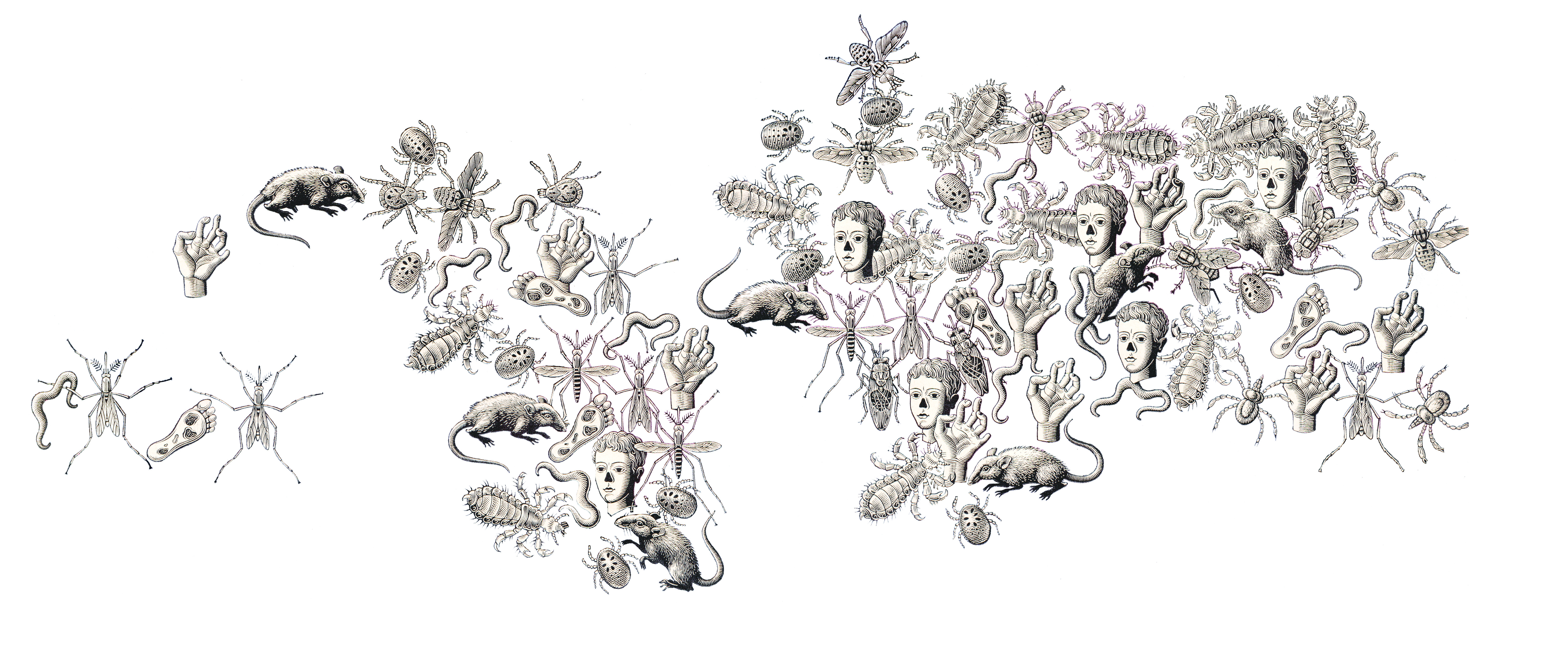
Boris Artzybasheff was born in 1899 in the Ukranian city of Kharkov. His father was author Mikhail Artsybashev. He emmigrated to the U.S. in 1919. Artzybasheff created 219 covers for Time Magazine between 1942 and 1966. He was also a commercial graphic designer and worked for the U.S. Department of State during and after WW2. He is best known for his grotesque and surrealistic graphic work (source). Just google his name, or see a gallery of his diverse work here.

The tropical diseases map is relatively conventional except for the 14 disease symbols Artzybasheff crowded on the map. If the point was to make those who peered at the two-page spread feel uncomfortable, the map hit its mark.

Mapping conventions are so imposing that even the most distinctive and creative map maker bows to convention over creativity. Not quite so, at least in this case, with Artzybasheff. The symbols are a prime example of Artzybasheff’s style, grotesque neo-realism, with a whif of the macabre; one of the prime instances where a major graphic artist applied his aesthetic, largely unimpeded, to the cartographic arts.

artzy_disease_map_crop_clean_transp.jpg

Screen Shot 2019-01-16 at 10.21.32 AM.png

Artzybasheff’s Maps and other Information Graphics

1940septfortuneapilot'sblackout “In the late 1930s and early 1940s Artzybasheff began illustrating articles for Fortune and other popular magazines, usually with vividly drawn graphic renditions of maps or other informational diagrams. In the September, 1940 issue of Fortune magazine, for example, Artzybasheff provided a striking and colorful illustration for an article on how military pilots experience oxygen deficiencies and aeroembolism (decompression sickness or temporary blackouts attributed to nitrogen bubbles that form in the spinal fluid) when ascending rapidly to heights of 30,000 feet.” (Williams, 2007, p. 126). Diagram (left): “A Pilot’s Blackout,” from “Selection of Military Pilots: Not Every Flyer is Fit for Combat,” Fortune, September 1940, p. 81.

SH316.jpg

“In another, he provided a clear and detailed map of China’s main roads and rivers, showing which areas were under Japanese control, and how Chiang Kai-shek was dealing with the distribution of oil and other natural resources.” Map: “China in Japan,” Fortune, December, 1940, 106.

Work for the U.S. Department of State

Artzybasheff had other cartogaphic ties during and after WW2, driven by his friendship with S.W. Boggs, the U.S. Department of State’s official geographer (1927-1954). “Boggs was responsible for initiating partnerships between artists such as Artzybasheff and the State Department for technical cartographic advice and map production, but in the process absorbed an appreciation of these artists’ global visualization and their sense of the larger American public.” (Barney, 2011, p. 186)

Artzybasheff “…became advisor to the US Department of State and Psychological Warfare Branch, institutions heavily involved in the marketing of national policies and war propaganda. The war had been a period of active political involvement both for Artzybasheff and his wife, who was employed as recruitment chairman in the Manhattan Volunteer Office of Civilian Defense.” (Patsiaouras, Fitchett, & Saren, 2014, p. 127).

There is mention of an atlas by several sources, the earliest being R. John Williams in 2007: “Artzybasheff also worked as a geographer for the State Department, and developed an atlas that would be used by the U.S. Army Training Command, providing important visual information to military strategists in Europe.” (Williams, 2007, p. 140). Williams does not cite the source for this information, and I have not found any evidence this atlas was published (although it may be in an archive somewhere).

Boggs also enlisted Artzybasheff as a consultant on a 1947 film called Expanding World Relationships. The film was distributed by the U.S. Information Agency. (Barney, 2011, p. 189-191).

A final Boggs inspired project involved an effort to communicate the impact of map projections on perception of the earth and global political relations. The outcome was published in an article called “Global Relations of the United States” in The Department of State Bulletin (vol. 30, #781, June 14, 1954, here).

boggs_artzy_1954_fig3“In a 1942 letter to Artzybasheff, Boggs asks if the artist could potentially draw the head of a man on a white billiard ball, in hopes of designing a model that could show how projecting global features creates significant distortions on a flat map—in other words, flattening the nations and populations of the world is much like flattening a person’s face beyond all recognition. As he points out to Artzybasheff, ‘What I would like to get across to the ‘flat-mappers’ is that when we are looking at a flat map which includes the whole world, we are looking at a caricature which is analogous to representing the face, both sides of the head, back and top of the head, and beneath the chin all on one flat surface.” (Barney, 2011, p. 189)

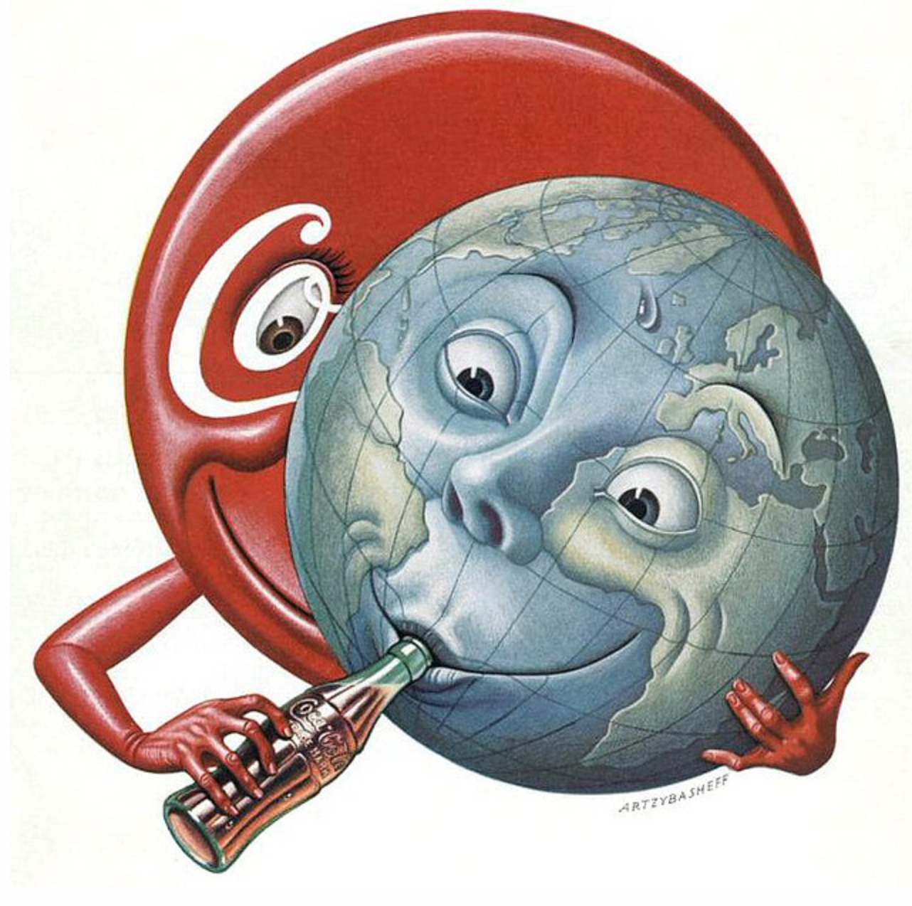
The outcome, also illustrated in”Global Relations of the United States” was not particularly successful as these types of diagrams go. The face did not cover enough of the sphere to be distorted that greatly, and what we are left with is the tonsured hair of the figure spread about the projected illustration.

boggs_artzy_1954_fig4a.png boggs_artzy_1954_fig4b

Sources

Timothy Barney, (Re)Placing America: Cold War Mapping And The Mediation Of International Space, Dissertation, University of Maryland, 2011. Direct PDF download here. Published as Mapping the Cold War: Cartography and the Framing of America’s International Power, 2015.

Georgios Patsiaouras, James Fitchett & Michael Saren. “Boris Artzybasheff and the Art of Anthropomorphic Marketing in Early American Consumer Culture.” Journal of Marketing Management, Vol. 30, Nos. 1–2, pp. 117–137, 2014.

R. John Williams. “‘I Like Machines’: Boris Artzybasheff’s Machine Aesthetic and the Ends of Cyborg Culture.” Technoculture: Special Issue of Interdisciplinary Humanities 23.1, pp. 120-142, 2007. PDF here.


A few additional Artzybasheff maps follow.

The cover for Time Magazine (May 15, 1950) was graced by a Coke sucking earth:

1950_Coke_Time_Cover_May15_1950.png

“Cosmos of the UCC,” from Fortune, June 1941. UCC is Union Carbide & Carbon Corporation.

38

A map to accompany an article “The Industrial South” (Fortune, November 18, 1938) is not unlike the style of Erwin Raisz (previously, on this blog) in its use of pictorial map symbols.

1938_Nov_18_Fortune_IndusSouth_closeup.png

1938_Nov_18_Fortune_IndusSouth.jpg

“Chemical Valley” (West Virginia’s Kanawha Valley) from the September 1941 issue of Fortune:

1941_sept_fortune_chemical_valley_close

1941_Sept_Fortune_Chemical_Valley.jpg

“The Last of the Free Seas” was published in Fortune in July of 1940.

1940_July_Fortune_Great_Lakes_detail.png

1940_July_Fortune_Great_Lakes.jpg

Denis Wood’s delightfully snarky review of a new book, The Power of Maps, but not The Power of Maps he wrote in 1992. The review provides a critique of participatory mapping and GIS from the perspective of critical cartography that has developed over the past several decades.


pomcover

Review: The Power of Maps: Bringing the Third Dimension to the Negotiation Table

C. Pedrick (editor)

Technical Centre for Agricultural and Rural Cooperation (CTA)

Order book or free PDF here.

by Denis Wood

Interesting title, The Power of Maps. Once I wrote a book called The Power of Maps (Guilford, New York, 1992), but that was then and this book was just published. My book was about how maps, instead of being objective and neutral, were interested, and about how hard maps labored to mask this interest. In the end it was about maps as malign instruments that hid their commitment to advancing the interests of those who commissioned them.

CTA’s The Power of Maps is one of these masks.

Or maybe I shouldn’t put it that way. That may be too harsh, too sweeping. But, my god, just take a look at the cover! In the upper right is the boxed phrase, “Success Stories,” letting us know right off that we’re in for some kind of fluff. Below, bracketing the title, are photos of a landscape and of a bunch of kids clustered excitedly around a three-dimensional model of it, or at least we assume the model’s of the pictured landscape (we hope it is): it’s never stated. The kids, a diversity of ages, are proud, and as we later learn, they should be, since presumably these are the kids who made the model. “Bringing the third dimension to the negotiation table,” says the subtitle, though these kids don’t look like they’re negotiating anything and, as it turns out, they’re not.

All sorts of prefatory fluff precede twelve stories with titles like “Mapping in Madagascar – from skepticism to ownership” and “Scaling up P3DM: A powerful community engagement tool.” The exciting titles are unfolded in exciting texts. Wonderful things happen when participatory 3D models are constructed. Generations come together (since the youth build the model which “the elders” interpret), people who have trouble with maps move over the model with ease (as we can see in the photos), government officials are impressed (evidently), and soon … everybody’s negotiating, they’re taking their future into their own hands, they’re triggering green lights for environmental restoration.

In these stories it’s almost magical the ways these things happen. The kids just build the model; the elders cluster around it annotating it with colors, yarn, pushpins; the officials just show up. In better than three dozen full-color photos, kids happily work, elders eagerly collaborate, attentive outsiders look and listen. P3DM really is magical! It really works!

That this a profound illusion The Power of Maps reveals only in its list of further readings on page 67 (the whole document runs only 74 pages). The first item, Giacomo Rambaldi’s Participatory Three-dimensional Modeling: Guiding Principles and Applications: 2010 edition runs 98 pages, each crammed with facts, figures, diagrams and tasks, tasks, tasks. There’s a lot to do before the locals can start making their model, and lots of outsiders are going to work to get it done. To begin with:

Organizing and facilitating a P3DM exercise requires a multidisciplinary team with at least three facilitators covering – as an example – the following disciplines: geography/cartography/GIS; natural resource management/environment; and social sciences. (p. 52)

and:

Logistical aspects vary from project to project. The more complex the initiative the more demanding are the logistical arrangements. All projects, whether they involve single or multiple communities and ethnic groups scattered over a large area, must handle logistical details for field activities, workshop venues, travel, accommodation and catering for community members and technical staff. Other matters to be arranged include contracts for a venue sufficiently large and possibly with electric power to allow the manufacture of the model, board and lodging, equipment rental or purchase and procurement and safe storage of supplies including the base maps. Additional staff may be hired and vehicles made available – in short, a variety of logistical arrangements are required for the project to run smoothly. All of these arrangements must be made in a timely fashion, and many must be in place during the earliest stages of the project and before project activities get underway. (p. 31)

That’s my emphasis, but there are lots of people from the outside who are going to be involved, and it all has to be paid for (materials for the model alone will run about a thousand bucks), there are salaries, and so there are sponsoring agencies and so on (and so on). While there’s a philosophical inclination to insist that these projects are “demand driven” – by the locals – it’s plain enough that they’re instigated by the agencies funding the work and so they’re in pursuit of agency goals.

Further along in the further-readings is CTA’s “Training kit on participatory spatial information management and communication” (2010). This consists of fifteen modules, most of which contains four units, none of which takes less than an hour, which is to say we’re talking about a commitment of more than 60 hours, and that’s without all the stuff they ask you to download and read or watch. Working through this training kit demands a serious chunk of time and energy. But, then, the whole thing does. The least of it is the construction and interpretation of the model, since once that’s done the whole thing has to be turned into a GIS, and maps have to be made. Maps, as my Power of Maps made plain, will be the tools used to implement any action, which since these are more or less all government projects, pretty much goes without saying. The 3D models are really about securing buy in, consensus, on the part of the locals.

I’ve critiqued participatory mapping before, in the keynote, “Public? Participation? Geographic? Information? Systems?” that I gave to the 2005 URISA Conference on PPGIS in Cleveland. The title should make the nature of my complaint clear enough. At the time I was unaware of Bill Cooke and Uma Kotiiari’s Participation: the New Tyranny? (Zed Books, London 2001) which examines many of my complaints in piercing detail; and I certainly didn’t know of Cooke’s “Rules of thumb for participatory change agents” (from Samuel Hickey and Giles Mohan’s Participation – From Tyranny to Transformation?, Zed Books, London, 2004), the first of which is, “Don’t work for the World Bank,” which naturally enough turns out to have funded “Mapping in Madagascar – from skepticism to ownership.” In fact, most of the projects laid out in The Power of Maps violate most of Cooke’s rules. One of these, “Data belong to those from whom they were taken,” includes “The use of photographs of participants in presentations and publications without their consent, informed or otherwise.” Again, nearly every one of the better than four dozen photos in The Power of Maps consists of photos of the people, the kids, the adults, the “elders” and, far more rarely, the government and NGO folk involved. Can you imagine the photographer of the image on the cover scurrying around to solicit the permission of each of the 23 caught? (Why bother? They’re mostly kids.) Under the same rubric Cooke mentions the use of material gathered in one capacity, as a participatory change agent, in another, for example as an academic in a journal, again without permission. Further he notes the public disclosure of information, in conferences or faculty staff rooms, again without permission, and contrasts this with the censure that would clobber people working with First World clients (therapists, for example).

There are others – the skewed rates of pay offered locals, government employees, and consultant academics – but to work through the list would be too disheartening. Worst of all is the way this – all this! – and more is obscured in The Power of Maps behind a curtain that could conceal an Oz. It’s this above all else that raises my ire, who tried to expose precisely this kind of deceit in a book whose title probably should have been The Real Power of Maps. Worst did I say? No, that’s actually not the worst of it. The worst of it is the startling lack of evidence that all this cardboard and plaster and paint and yarn has paid off in significant benefits for the locals, who end up no more than exposing their local knowledge to outsiders whose ultimate goal is buy in from the locals.

Okay, I’m carping from way outside, and by no means want to castigate all the work accomplished with P3DM which is often a huge improvement, if nothing else, over the options. And maybe it’s just their use of my title, over which of course I have no title. But there’s something about this self-congratulatory volume that sticks in my craw. Why couldn’t they have called it, The Power of 3D Models or The Use of 3D Models? Or better yet Preparing the Ground for Capitalism?

And now… what at least a dozen of you have been waiting for…


mm3

Denis and I spent quite a bit of time rethinking significant parts of the second edition of Making Maps in several intense work sessions in Columbus, Ohio and Raleigh, North Carolina. Fists were pounded upon tables, changes demanded, reservations expressed, ideas refined, markers used to blot out the unacceptable and sketches drawn for new sections in the new edition. It was terrible fun.

It explains my lack of posts here at the Making Maps blog.

While the overall design of the book remains consistent with the 2nd edition, those of you with a technical bent will appreciate that the 2nd edition was entirely created in Freehand MX and Guilford and I translated the entire book to Adobe Illustrator and InDesign for the 3rd edition. You have no idea how much trouble that was.

After Denis and I settled the changes and updates, I spent over a year and a half producing the maps, graphics and text for the book, many hundreds of hours of research and production. A significant amount of the work was completed while sitting at my daughter Annabelle’s synchronized swimming practices (11 hours a week!). I can still smell chlorine when I look at the book.

Changes in the 3rd edition of Making Maps include:

  • 40+ new pages of content
  • expansion of substantive color examples by 25%
  • 35+ new, map exemplars throughout book
  • changes on over 50% of the pages in the book
  • new introductory maps including
    • Jack Kerouac’s hand drawn map he drew while planning On the Road
    • Boris Artzybasheff’s creepy map of global tropical diseases
    • Gwendolyn Warren and Bill Bunge’s famous map of Children’s Traffic Fatalities in Detroit
    • Guy Harold Smith’s Physiographic (and typographic) map of South America
  • expansion and split of chapter 9 on map symbolization into two chapters, focusing on map symbols of less and more abstract geographic data
  • significant expansion of the graphic novel, extended throughout the book, as an exemplar how making maps can change the world

But that’s not all…

  • expanded discussion of when mapping is inappropriate
  • updated content on map medium guidelines
  • addition of content on viewing distance rules
  • expanded discussion of Impact Evaluation with new fracking oil shale example
  • expanded discussion of time and mapping, including mapping the future
  • addition of content and examples of geodata locational services and privacy
  • addition of geoweb concepts including interoperabily, open data layers, tile maps
  • extensive refinement and clarification of map projection terminology
  • discussion of when map projections don’t matter
  • updated data in maps on poverty, hate groups, firearms deaths, election results, African American absence, etc.
  • new maps on slavery and lynchings in the US
  • expanded discussion with 10 new examples in Ways to Think about Map Symbols section
  • new two pages section on symbolizing terrain
  • new section on Ways to Think about Map Symbolization Abstraction with new maps on Detroit children traffic fatalities
  • reorganization of Color chapter into a more logical progression with a trio of new Voyager maps showing monochrome, two color, and full color examples
  • revision, expansion, and updates of More information sections in each chapter
  • new map quotes

Despite 40 new pages of material in the book, it is still under 300 pages. No bloat here – no “book junk.”

I’ll post more bits from the book in the coming weeks, months, …

And the book starts thusly…

Screen Shot 2016-07-29 at 11.00.26 AM Screen Shot 2016-07-29 at 11.00.39 AM Screen Shot 2016-07-29 at 11.00.49 AM Screen Shot 2016-07-29 at 11.01.03 AM Screen Shot 2016-07-29 at 11.01.15 AM Screen Shot 2016-07-29 at 11.01.32 AM Screen Shot 2016-07-29 at 11.01.45 AM Screen Shot 2016-07-29 at 11.01.59 AM Screen Shot 2016-07-29 at 11.02.09 AM