
Archive for the ‘01 What’s A Map?’ Category
Making Maps now at makingmaps.substack.com
Posted in 01 What's A Map?, 02 Why Are You Making Your Map?, 03 Mappable Data, 04 Map-Making Tools, 05 Geographic Framework, 06 Map Layout, 07 Hierarchies, 08 Generalization & Classification, 09 Map Symbolization, 10 Type on Maps, 11 Color on Maps, 12 Finishing Your Map, tagged Cartography, data analytics, Denis Wood, Geographic Information Systems, geospatial, information design, John Krygier, Making Maps, maps on January 17, 2025| Leave a Comment »
Book Review: Matthew Edney: Cartography. The Ideal and Its History
Posted in 01 What's A Map?, 02 Why Are You Making Your Map?, 03 Mappable Data, 04 Map-Making Tools, Deep Map Thoughts, Map Books, Map History on June 30, 2020| 1 Comment »
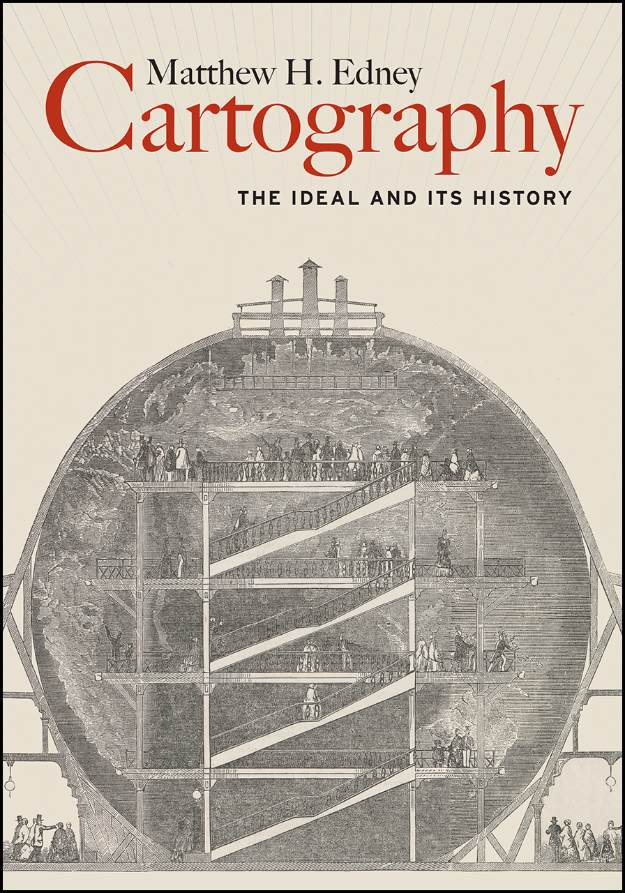
Matthew H. Edney. Cartography. The Ideal and Its History. xiii + 309 pp., figs., bibl., index. Chicago: The University of Chicago Press, 2019. $30.00 (paper), ISBN 9780226605685.
Matthew Edney @ USM
Matthew Edney @ Mapping As Process
University of Chicago Press Book Information
Book Review by John Krygier published in Isis: A Journal of the History of Science Society—Volume 111, Number 1, March 2020 (pp. 207-208)
There is no such thing as cartography, and this is a book about it. (p. 1)
Matthew Edney’s Cartography: The Ideal and its History provides a necessary corrective to the normative ideal of maps, mapping and the field of cartography. While of interest to scholars in the history of cartography, Edney’s book is just as important to the growing number of scholars whose research engages maps and mapping as part of diverse studies of culture, society and human history. Cartography: The Ideal and its History details problematic assumptions about maps, mapping and cartography, but it’s the creative potential of Edney’s book that’s most notable. As untenable assumptions are discarded, new insights emerge, insights which have the potential to greatly expand our understanding of maps and mapping across many different studies and disciplines.
Edney’s Cartography is situated in the intermingled fields of the history of cartography and critical cartography with touchstones including The History of Cartography, Book 1, edited by J.B. Harley and David Woodward (1987), Harley’s “Deconstructing the Map” (1989) and Denis Wood’s The Power of Maps (1992). These works, and many that followed, undermined narrow definitions of the map and broadened our understanding of the cultural, social and political context of mapping. Edney’s work as editor of later volumes of the History of Cartography, extensive publications on maps from Europe, North America and India as well as critical cartography make him an ideal scholar to take on the ideal of cartography. He does so by characterizing the traditional study of maps and mapping as “a profound act of cultural misdirection.” Maps and mapping are more complex, nuanced and disjunct than the universalizing, idealized conceptions offered by modern cartography, a thesis strongly supported by Edney’s immersion in diverse historical maps and mapping practices.
The most appealing parts of Cartography: The Ideal and its History are the delineation of fourteen modes of Western mapping and an intellectual assault on cartography’s idealized preconceptions. These issues are addressed in the first third of the book, prefaced by a discussion of the ideal and its limitations. Mapping modes include place, urban, property, engineering, chorographical, cosmographical, geographical, marine, celestial, boundary, geodetic, analytic, and overhead imaging. The concept of modes shifts focus away from a singular, idealized map (and map making process) to distinct (but evolving and interrelated) map types and processes that are better understood free of the narrow, idealized context within which they are typically situated. Cartography’s idealized preconceptions include ontology, pictorialness, individuality, materiality, observation, efficacy, discipline, publicity, morality and singularity & universality. In each case, Edney describes, critiques, and offers alternatives to these preconceptions. With the concept of mapping modes and critique of preconceptions in place, an intellectually sophisticated, nuanced and creative understanding of maps and mapping processes can play out.
Chapter 4, The Ideal of Cartography, details the construction of cartography as “a modern myth.” The chapter weaves in references to mapping modes and idealized preconceptions. One is left, upon finishing this chapter, with a history of the construction of modern cartography as well as an understanding of its limitations. Chapter 5 critiques the idealized geometry at the heart of modern cartography, specifically map scale. Much like maps and cartography in general, it is easy to naturalize map scale. This chapter, like the rest of the book, brings a sense of unease: many seemingly natural aspects of our common understanding of cartography are carefully constructed myths.
Cartography: The Ideal and its History is scholarly, well-written and a significant contribution to the history of science. It covers some ground explored by other recent scholars (including Matthew Wilson’s 2017 New Lines) but with a stronger footing in historical scholarship. Edney’s mapping modes and idealized preconceptions provide actionable ideas which are often lacking in critical cartography literature. It’s not clear, however, if Edney’s work will have much of an impact on modern mapping practitioners (cartography, geographic information systems, Geospatial technology) or academics in these technical fields. The myth of cartography is, if anything, functional and serves the needs of particular people and groups (property ownership, the military, government bureaucracy, business, etc.). Online mapping and navigational tools, such as Google Maps, are rife with problems (such as the inclusion of fake businesses that generate income for Google and for companies who pay to have these businesses on the map). Alas, people find such services useful and don’t really think the maps and information they engage with are anything other than an image of the real world. At the very least, scholars should not fall into the same trap: Matthew Edney’s Cartography: The Ideal and its History provides a corrective, a reimagined intellectual framework for maps and mapping that will, when engaged and operationalized, greatly broaden our understanding of the wondrous array of inscriptions and practices we call maps and mapping.
John Krygier
Professor of Geography
Ohio Wesleyan University
Delaware, OH. 43015
jbkrygier@owu.edu
Denis Wood: Where? Nowhere
Posted in 01 What's A Map?, 02 Why Are You Making Your Map?, 03 Mappable Data, Deep Map Thoughts, Map Books on March 11, 2019| Leave a Comment »
Review by Denis Wood of
Katherine Marsh. Nowhere Boy (Roaring Brook, New York, 2018)
Glenda Garelli, Federica Sossi & Martina Tazzioli. Spaces in Migration: Postcards of a Revolution (Pavement Books, London, 2013).
James Cheshire and Oliver Uberti. Where the Animals Go: Tracking Wildlife with Technology in 50 Maps and Graphics (Norton, New York, 2017)
Where? Nowhere
One of them doesn’t exist.
What could that mean, doesn’t exist? Clearly he exists. He has flesh. He has bones. What he doesn’t have are … papers. Which is another way of saying … any rights. No rights. This is to say that spatially he has no right to exist where he does. Where he does? What could that possibly mean? Where else except where he is could he exist?
Well, nowhere, obviously. So this must mean something else. But it’s hard to say what. The boy we’re talking about is Syrian, which is to say that he was born in Syria and until recently lived there. Now he’s in Brussels, in the corner of a basement in a house whose other inhabitants don’t know he’s there. He comes out at night to filch a little food but is very quiet because if they knew he was there they’d turn him over to the authorities who would lock him up. Or send him back to Syria which he’d fled because of the war there. He had the right to be in Syria, but no way to be in Syria. He has a way to be in Brussels, but no right to be there.
Rights don’t seem to be very strongly connected to the way things are, to the actual state of things.
Rights are permissions granted to people by others. To say that the boy – his name is Ahmed – had no right to exist in Brussels is to say that those around him hadn’t given him permission to exist there. Well, this isn’t quite right either. Max had. Max was another boy living in the house, one who did exist, who did have a right to be there. A partial right. His family had moved there from Washington when his father was posted to Brussels. Max finds, he ferrets out Ahmed in the basement. The two become friends and Max abets Ahmed’s secret life in the house.
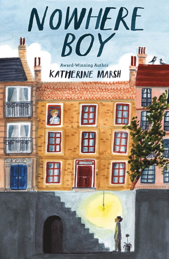
The boys are characters in Katherine Marsh’s Nowhere Boy (Roaring Brook, New York, 2018), a young adult novel about the refugees coming to Europe, these days through the desert and across the seas. Those fleeing to Europe are fleeing war and destitution and tend to be Muslim, which is pretty stigmatized in Europe. These people are not wanted, even in countries that desperately need their labor, like Hungary. Ironically Ahmed and Max end up in Hungary, in Kiskunhalas, near its border with Serbia, where Ahmed’s father is in detention. It’s a young adult novel, so it ends well. But until it does, Ahmed “didn’t want to go anywhere anymore. He felt safer being nowhere.”
Which is what not existing means: it means being nowhere.
Being nowhere means you can’t be plotted to a map. Not existing, being nowhere, and being unmappable are all vaguely synonymous. Of course they’re abstractions. One flesh and blood body can annihilate them all. Which is what Ahmed’s body did, violated the abstractions, rendering him existent, there, and mappable. This is also what the Tunisians from Lampedusa in Paris did when they occupied 51 Avenue Simon Bolivar, hanging out a banner that read, “Ni police, ni charité. Un lieu pour s’organiser.” Which is to say, “No police, no charity. A place where we can organize.” A place. They wanted a place which, nowhere, nonexistent and unmappable, they didn’t, they couldn’t have. What they had, two days later, were police, plenty of them, who forced them back onto the streets and so rendered them, once more, nonexistent, nowhere, and unmappable.
These were the harraga, “those who burn.” Meaning both “young people who ‘burn’ frontiers as they migrate across the Mediterranean sea and those who are ready to burn their documents (but also their pasts and eventually their lives).” The words are those of Paola Gandolfi from her “Spaces in Migration” in Glenda Garelli, Federica Sossi and Martina Tazzioli’s Spaces in Migration: Postcards of a Revolution (Pavement Books, London, 2013). “Spaces in migration” is an ambiguous phrase, implying both spaces moving in the process of migration (for example, the spaces moving with the migrants’ bodies) but also the spaces emerging in the process of migration (like 51 Avenue Simon Bolivar, like the detention facilities on Lampedusa). Either, or both of these taken along with the burning of frontiers and the burning of documents can melt the solidities, the certainties, of the contemporary system of nation-states.
Which are, after all, bounded places (states) with a population that is more or less culturally coherent (nations). There may be no true nation-states these days, given the bewildering range of peoples that live in even the smallest of them (Abkhazia, for example), but there are states galore, with ever more jealously guarded borders.
When these are “burned” by harraga it’s as though a body were being wounded, anything might get in, there would be no integrity, the body could come apart. So when the Tunisians started crossing the Mediterranean for France and reached Lampedusa, a minute island midway between Sfax, in Tunisia, and Malta, from which, thanks to a permit granted by the Italians, they were able to travel freely through the Schengen Area, you’d think the whole African continent was attempting to pour into Europe. The few thousand who initially reached Lampedusa, well, Lampedusa is small. It’s not eight square miles. But still, the first few thousands that arrived immediately aroused a language of Biblical proportions, of natural disasters: plagues, floods, tsunamis, simply overwhelming numbers which, in fact, didn’t amount to single thousandth of a single percent of the even the Italian population. Even in August when the number did reach fifty thousand it was still inconceivably small.
You’d think a dagger was being driven into the Italian, into the French heart.
The French closed its border with Italy. There was no way they were letting all these Tunisians into la patrie, despite their own earlier colonization of Tunisia. The French into Tunisia? Certainly. (And they didn’t give it up until 1956). But Tunisians into France? Unthinkable! To say nothing of the Libyans, who with their numbers soon revealed how few the Tunisians had been, the Eritreans, the Senegalese, the Syrians … All barely existent nowhere people on the move …
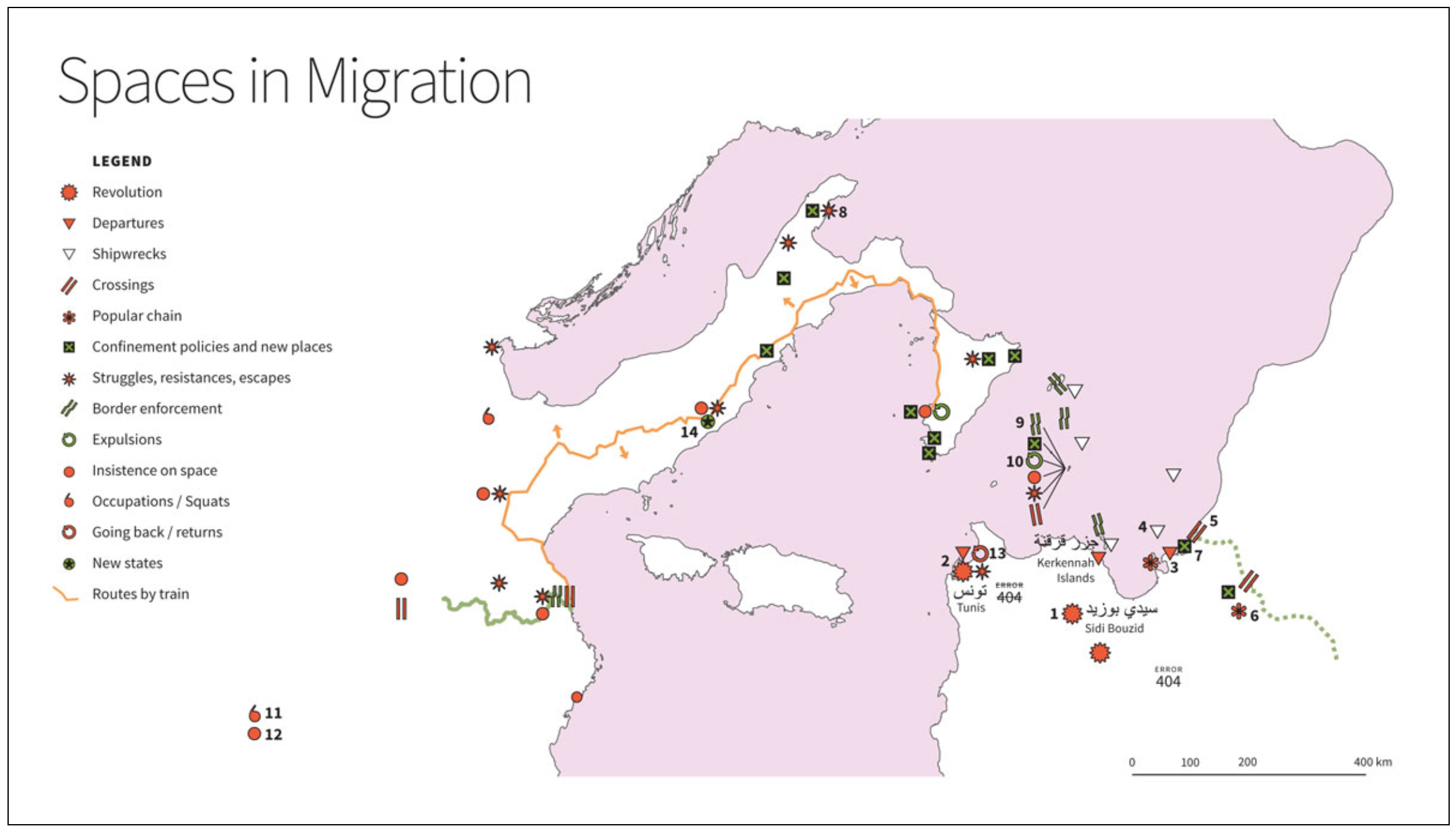
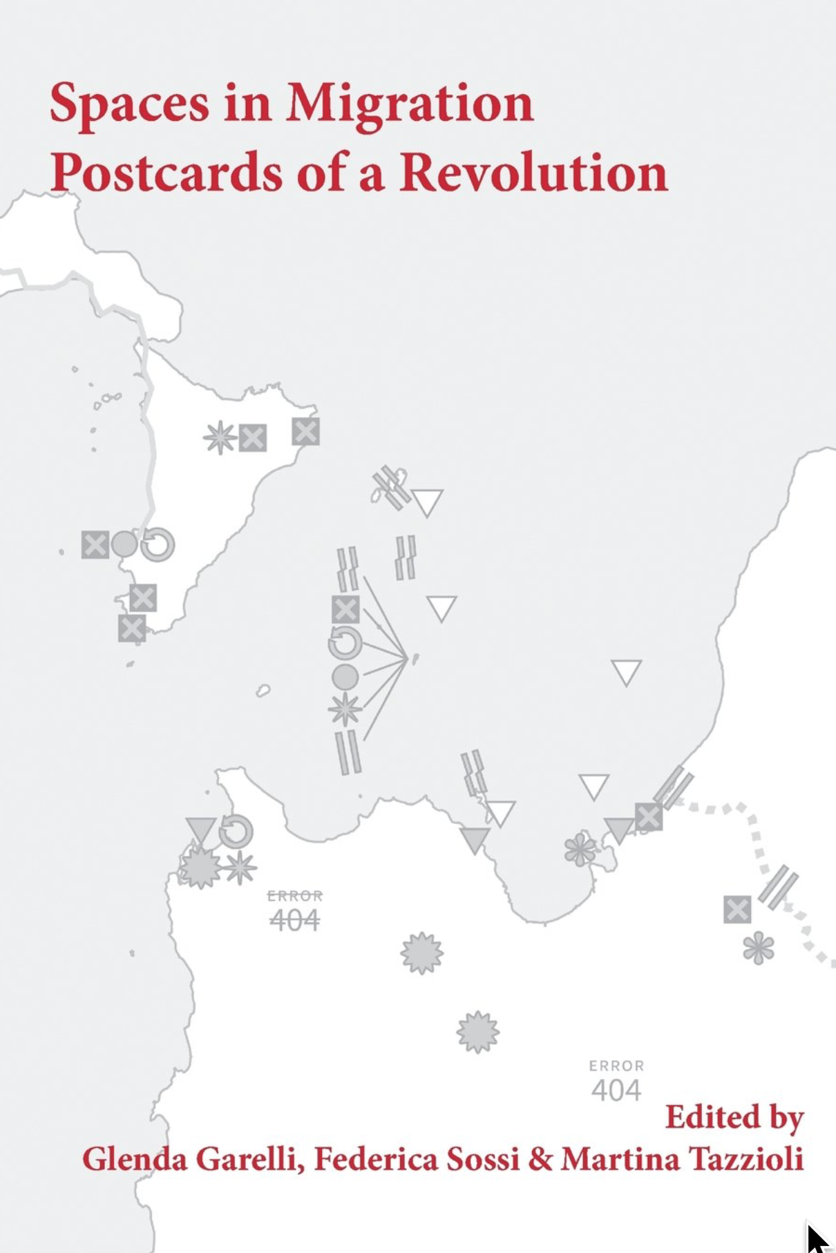
The map here may confuse some people. For one thing, north is to the left of the map. For another we’re not used to seeing this piece of the Mediterranean, turned this way, at this scale. Tunisia is in the lower right. That’s Libya above it. Lampedusa is the dot from which the items labeled 9 and 10, among others, are emanating. Paris is indicated by 12. Be that as it may, it’s astonishing how tight everything is, how close, how these two continents so firmly separated by Mohammed and Charlemagne almost kiss, even here in the middle of the sea. Lampedusa has kin, Linosa and Lampione. You can even see Tunisia from Pantelleria (it’s only 37 miles away). Despite this the rhetorical distance separating Europe and Africa remains all but uncrossable.
For the undocumented burning their way across it is crossable, but only as long as they remain nonexistent, nowhere, and unmappable. The problem is, “You start to get hungry, you smell and you only have one pair of jeans to wear. You never take your shoes off and your feet hurt. You call home, not too often, to let them know you are still alive but you do not speak of your insistence on space, and sometimes you start to think about returning. You even go as far as to insist on consulate offices to try to work out how to get home. But you burnt a border when you left on a boat, one that won’t allow you to burn it again on the return journey.” This comes from Garelli, Sossi, and Tazzioli’s “Postcards of a Revolution,” the conclusion to their book (it’s also online here). This is as close as you can get to despairing without actually giving up.
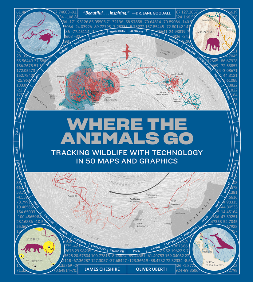
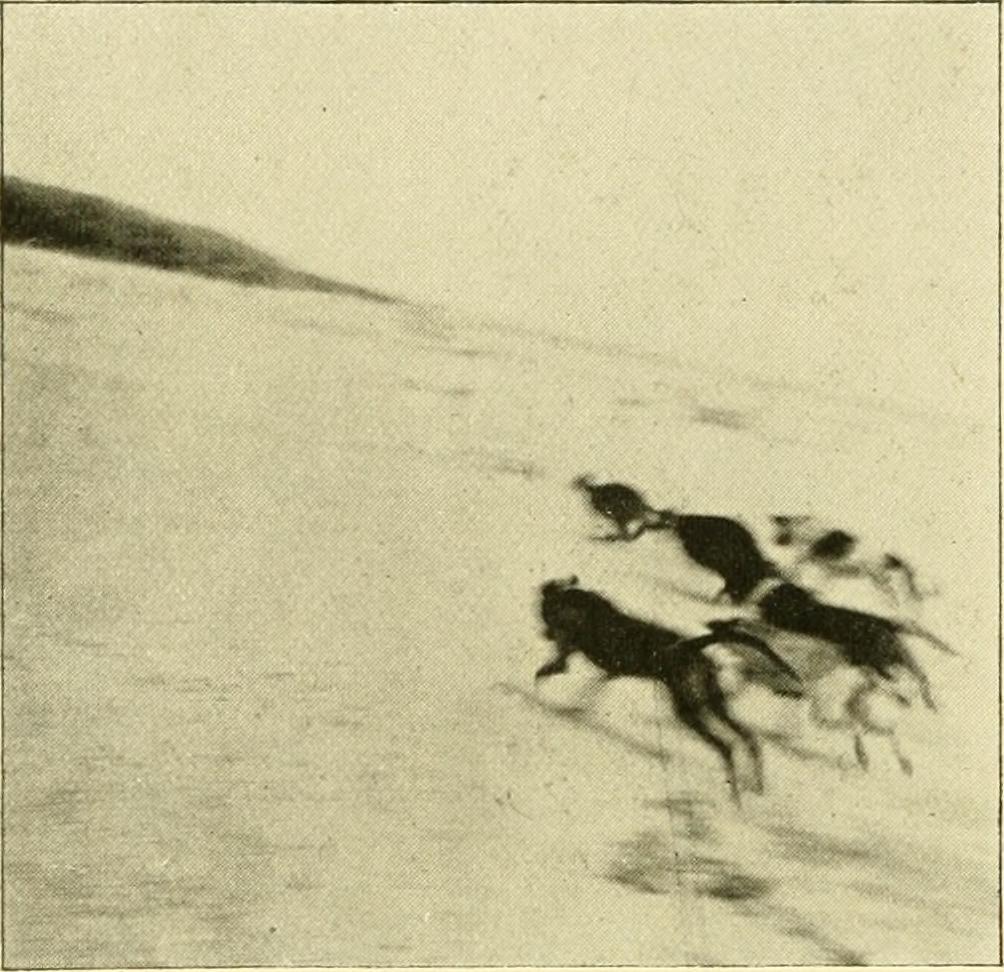
Placeless: often this is to say on the move, and since in motion, unmappable, wherever they may happen to be. It’s hard to map things in motion. All the ways we’ve developed are workarounds. Some of the best of these are captured in the recent book, Where the Animals Go: Tracking Wildlife with Technology in 50 Maps and Graphics (Norton, New York, 2017) by James Cheshire and Oliver Uberti. Like Ahmed in Brussels, like the Tunisians in Paris, animals too are undocumented, and like Ahmed and the Tunisians they too burn borders without hesitation. If they’re even aware of them.
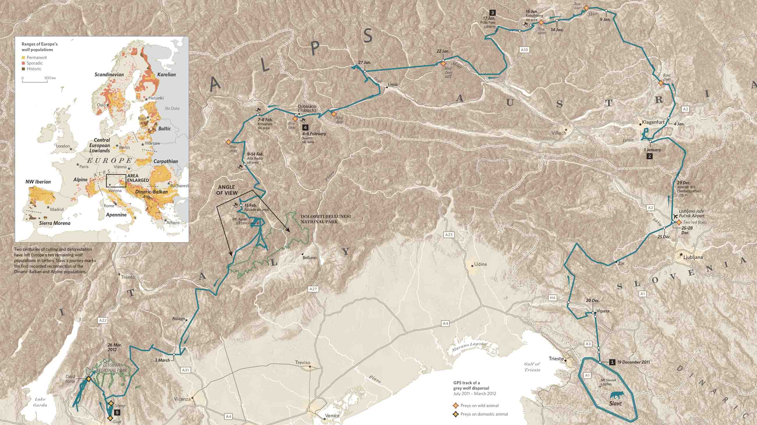
Take Slavc, a young wolf from the mountains on the Croatian-Slovenian border. He left his maternal pack and struck out on his own, crossing motorways and major rivers, navigating the Dolomites in the middle of winter and the suburbs of Verona; moving from the Dinaric Alps, across the Drava into the Alps, and so from Slovenia into Austria, and into and through the Dolomites, which is to say into Italy, before settling in the upper plateau of Monte Lessini. Slavc leaves Croatia, crosses Slovenia and Austria, and slips into Italy, all without so much as a by-your-leave from a single border agent. Of course he’s not a human so … who cares?
That he’s visible at all is because he’d been radio collared by a University of Ljubljana conservationist who tracked his GPS transmissions. The collar sent about seven locations a day, allowing Hubert Potočnik to interpolate the rest of Slavc’s movements. Mostly he moved at night, more like Ahmed than the Tunisians. He didn’t kill a domestic animal until he reached the outskirts of Verona, so if he hadn’t been radio collared he would have been completely invisible.
The carnivore at the top of the food chain is less easily hidden and, when seen, needs to be able to exhibit papers. The simmering European refugee “crisis” has led to an armoring of border and after border, including the one in the Dinarics that Slavc crossed between Croatia and Slovenia. The Dinarics are home to many animals that now move freely across the Slovenian and Croatian border, wolves, obviously, but also, among the collared, lynx and bears. The borders that impede the movement of Syrians and Eritreans also impede and usually preclude the movement of all the larger mammals. Impenetrable barriers are horrifying intrusions into their lives and genetically disastrous.
But what is this terror of the mobile? Only that it implies the fragility of the police states into which most modern states have evolved. Is there any that lacks its apparatus of control, its mechanisms for identifying, tracking, apprehending and expelling any it stigmatizes as unwelcome? It has less success with wolves, with storks, with whales but only because, inhuman, they’re less subject to scrutiny. As we have seen this has its downside: unintended control by barriers meant for humans. How many animals moving back and forth across the US-Mexico border will be trapped on one side or the other by Trump’s wall? How many will have their ranges severed? How many will be separated from their families?
I think it’s easy enough to answer, “Enough, enough will be separated from their families,” just as Ahmed was separated from his, as the Tunisians were separated from theirs, as animals around the world are separated from theirs.
Why do we even care where any of these are?
Isn’t it enough to know where we are? And when you stop to think about it, isn’t that hard enough?
Found Maps & Etc. Junk 10
Posted in 01 What's A Map? on November 17, 2015| 1 Comment »

Electric Street Weather Map, Atlantic City, NJ (NJ Department of Agriculture), 1917

3D map (peg model) of the Coyote Hills oil field, California. (1910)
 Image from page 15 of “American Fixture Company: Catalog 4” (1920)

Map of saloons, lower Druid Hill Avenue District, made by the Colored Law and Order League, Baltimore, Md” (1908)

Image from page 126 of “Light and lighting” (1908)

“Meats” from page 89 of “The everyday cook and recipe book.” 1891

Comparative map: Africa vs US, China, India, Europe. (1915)

Temperance Education Map of the United States. (1898)

Map of Collect Pond, Giving the Present Site of The Tombs, as Drawn by John Canter, The Counterfeiter. (1874)

Portion of Map Showing Estimated Time Saving by Rapid Transit Lines as Compared with Present System used: the average subway-elevated speed, 16 m.p.h., the average surface car speed, 8 m.p.h., and the average pedestrian speed, 3 m.p.h. A differential of three minutes was allowed for walking up and down the stairsat subway-elevated stations. (1908)

Image from page 248 of “Light and lighting” (1908)

Image from page 248 of “Light and lighting” (1908)

Image from page 57 of “Bay County past and present” (1918)
Junk found while searching for stuff for the 3rd edition of Making Maps: A Visual Guide to Map Design for GIS. Out late Spring 2016.
Found Maps & Etc. Junk 9
Posted in 01 What's A Map? on November 5, 2015| 2 Comments »

Hazel Lee annotates the map of Russia. From “Advanced Geography.“ (1899)

Hole cut in the map. From “Advanced Geography.“ (1899)

Type borders: Torn, curled, damaged paper effect fonts. (1897)

Map: Township 40, Hamilton County, NY (1900)

“With monstrous head and sickening cry and ears like errant wings.” Image from page 49 of The Year’s at the Spring; An Anthology of Recent Poetry (1920)

Map: Races of Man (1848)

Map: Calves Slaughtered Under Federal Inspection 1920-21.

Map: Bee Colonies on Farms. (1920)

Map: Watermelons Grown. (1919)

Image from page 503 of “Transactions of the American Climatological and Clinical Association.” (1914)

Image from page 473 of “Illinois as it is” (1857)

Image from page 4 of “The Germania and Agricola of Tacitus” (1850)

German propaganda poster, 1920.

Variation of Road Widths and Sections to Suit Traffic: The above road sections show the variation in the width of roads proposed to be permitted under a Town Planning scheme of Great Yarmouth in England. (1917)

Sunlight Curves in Streets. (1917)
Junk found while searching for stuff for the 3rd edition of Making Maps: A Visual Guide to Map Design for GIS. Out late Spring 2016.
Found Maps & Etc. Junk 8
Posted in 01 What's A Map? on October 27, 2015| 1 Comment »

New York City: Map of New Track Capacity. (1914)

Image from page 983 of “A system of instruction in X-ray methods and medical uses of light, hot-air, vibration and high-frequency currents.” (1902)

Map: Saloons in San Francisco. (1901)

Map: Saloons of Buffalo, 1901

Map of Saloons: New York, Jewish Quarter, 1894

Image from page 427 of “Journal of electricity” (1917)

Sprayed apples, Image from page 584 of “Annual report, New York State Museum” (1902)

Fire tests on building columns. (1917)

Map: US Cantaloupe Shipments, 1914.

Typography specimen: Social Dang Germans (1897)

Typography specimen: House Dogs (1897)

Image from page 176 of “The Maule seed book for 1922” (1922)

Map: Kafir Acreage in Kansas, 1912.
Junk found while searching for stuff for the 3rd edition of Making Maps: A Visual Guide to Map Design for GIS. Out late Spring 2016.
Found Maps & Etc. Junk 7
Posted in 01 What's A Map? on October 22, 2015| 3 Comments »

Image from page 86 of “Scenes from every land, second series. (1909)

Map of Malarial Mosquito breeding areas, Carbondale, Illinois (1918)

Image from page 93 of “Elizabeth City State Teachers College Catalog” (1909)

Map: To show distribution of 17 scaled Kraits — Ventrals 194-237, subcaudals 43-52 (From records of 19 specimens in my note books). Implies uncertain limits. (1913)

Map: Port Natal, Harbor (1911)
Full map download PNG. Source: Natal Province: Descriptive Guide and Official Hand-book by A.H. Tallow (1911)

Image from page 351 of “Natal province : descriptive guide and official hand-book” (1911)

Egg shapes, 1920

Sketch Map of Elizabethan London (1908)

Poisons for little children (1916)

Image from page 63 of “Physical culture” (1899)

Electrical conduit standards charts. (1914)

X-ray handshake map. (1917)
Junk found while searching for stuff for the 3rd edition of Making Maps: A Visual Guide to Map Design for GIS. Out late Spring 2016.
Found Maps & Etc. Junk 6
Posted in 01 What's A Map? on October 19, 2015| 1 Comment »

Simple suggestions for ring laying. (1913)

Simple Suggestions for Block Laying. (1913)

Map of United States Showing Relation of Depth of Pipes to Temperature. (1909)

Organized desk (1918)

Map: Land tenure, peasants, Shirokij Log, Russia (1913)

Map: Land tenure, peasants, Novoselok, Northern Russia (1913).

“Bird children, the little playmates of the flower children” (1912)

Map: United States – Airways, 1921.

Image from page 50 of “The street railway review” (1891)

Image from page 262 of “Local and regional anesthesia (1920)

Map showing operation of Map and Tack system for planning and routing salesman (1921)

Image from page 30 of “Osteopathic first aids to the sick: written for the sick people” (1906)
Junk found while searching for stuff for the 3rd edition of Making Maps: A Visual Guide to Map Design for GIS. Out late Spring 2016.
Found Maps & Etc. Junk 5
Posted in 01 What's A Map? on October 14, 2015| Leave a Comment »

Child Street Arrests, New York, 1915.

Map: Line of Deposition. (1904)

Aniline Black. (1874)

Map: Goiter Distribution, Washington. (1917)

The Melting Points of Fire Brick. (1912)

Image from page 1026 of “Essai philosophique concernant l’entendement humain : ou l’on montre quelle est l’extendue de nos connaissances certaines, & &c la maniere dont nous y parvenons” (1723)

Map: Annual lumber consumption for the manufacture of boxes, crates, fruit and vegetable packages. (1921)

Goethe, Zur Farbenlehre. (1810)

World Map, Population, 1917.

Colors: Table of Greens and Russets (1871)

Image from page 102 of “Three essays : On picturesque beauty; On picturesque travel; and On sketching landscape : with a poem, on landscape painting. (1825)

Seismographic record of the 1906 earthquake at the Chabot Observatory, Oakland California (1906)

Ontario Sessional Papers, No.31-35. (1907)

Image from page 16 of “Transactions of the American Ceramic Society.” (1907)
Junk found while searching for stuff for the 3rd edition of Making Maps: A Visual Guide to Map Design for GIS. Out late Spring 2016.
Found Maps & Etc. Junk 4
Posted in 01 What's A Map? on October 12, 2015| Leave a Comment »

Map: Illinois Praries, Woods, Swamps and Bluffs (1857)

Image from page 412 of “Traité théorique et pratique de l’impression des tissus” (1846)

Chromatic Pin Map (1915)

Image from page 424 of “Traité théorique et pratique de l’impression des tissus” (1846)

Seaweed (1846)

Seaweed (1846)

Image from page 359 of “A pronouncing gazetteer and geographical dictionary of the Philippine Islands, United States of America with maps, charts and illustrations” (1902)

Image from page 60 of “A new elucidation of colours, original, prismatic, and material : showing their concordance in three primitives, yellow, red, and blue, and the means of producing, measuring, and mixing them” (1809)

Map: Glaciers, Ymesfield, Norway. (1853)

Image from page 43 of “Water & sewage works” (1913)

Image from page 24 of “Open air crusaders; a story of the Elizabeth McCormick open air school, together with a general account of open air school workin Chicago and a chapter on school ventilation” (1911)

The Economic Value of the Starling (1921).

Noses. (1890)

Simultaneous contrast. (1895)

Color: Harmonious arrangement of twenty five of the most useful pigments. (1871)

“The above cut represents Abe Lazy, the old original tramp, the man who served for half a century as a terror to women and children and a living demonstration that the world owes every man a living. He is dead now, died in the insane asylum at Harrisburg a short time ago, not that he was insane, but because no one wanted to care for him anymore.” Snyder County Annals (1895)
Junk found while searching for stuff for the 3rd edition of Making Maps: A Visual Guide to Map Design for GIS. Out late Spring 2016.
