Feeds:
Posts
Comments

Posts Tagged ‘Critical Cartography’

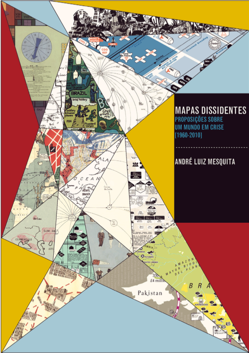
Cover of dissertation

André Luiz Mesquita’s dissertation (in Portuguese), Mapas Dissidentes: Proposições Sobre um Mundo em Crise (1960-2010), (Dissenting Maps: Propositions on a World in Crisis, 1960-2010), looks at the maps and diagrams of artists and activists from 1960 to 2010, all working in social, political, and economic contexts of crisis and change, conflict and various forms of resistance. He approaches the work of three generations of artists through an analysis of endless documents, catalogs, manifestos, articles, photographs, documentaries, art works, reproductions of maps, and interviews.

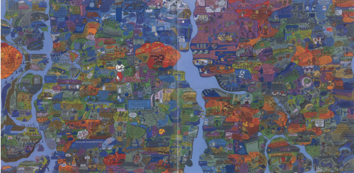
Mesquita begins by examining the games and maps created in the 1960s and ’70s by the Swedish-Brazilian artist, Öyvind Fahlström (1928-1976), made under the geopolitical tensions of the Cold War (1947-1991) and the structural and organizational changes in global capitalism of the 1970s.

Öyvind Fahlström's World Map

Öyvind Fahlström’s World Map

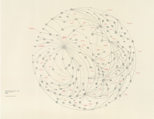
He then turns to the work of the American artist, Mark Lombardi (1951-2000), who, in the 1990s, mapped international power networks and obscure financial transactions involving banks, governments, and neoliberal elites.

Mark Lombard's World Finance

Mark Lombard’s World Finance

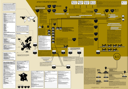
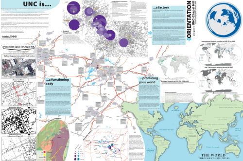
Finally Mesquita addresses the counter-cartography practices developed between the 1990s and 2010’s by three activist art collectives: Bureau d’Études (France), the Counter-Cartographies Collective (United States), and Iconoclasistas (Argentina). Based on the interrelations between contemporary art, political activism, and critical cartography, Mesquita holds that the work of these activists-artists has created a significant opposition to the “neutral and objective” maps made in the interests of corporate, governmental, and military bodies.

Bureau de'Etudes's Refuse the Biopolice

Bureau de’Etudes’s Refuse the Biopolice

•••••

Counter-Cartographies Collective's DisOrientation Guide

Counter-Cartographies Collective’s DisOrientation Guide

•••••

Iconoclasistas' Radiografía del Corazón del modelo sojero

Iconoclasistas’ Radiografía del Corazón del Modelo Sojero

What’s really exciting is the mining Mesquita has done, coming up with a range of map work that will surprise the causal observer of, say, Fahlström (in particular); but also the way he attaches all this work to that of antecedents (like the Surrealists and the Situationists) and parallels (as in the work of Trevor Paglen).

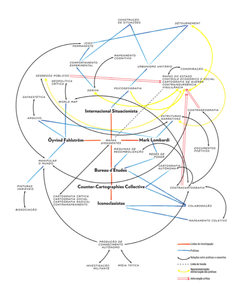
Structure of the dissertation's argument

Map of the Dissertation’s Argument

This is an important piece of work. Mesquita is currently working on a translation to English.

The full dissertation can be downloaded here or here (55.4 mb)
Contact André Luiz Mesquita

Read Full Post »

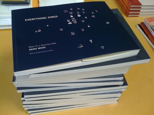
Denis Wood’s Everything Sings: Maps for a Narrative Atlas

Now shipping from Siglio Press

Use discount code PUMPKIN for 20% off until November 12, 2010

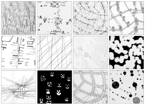
Three maps from Everything Sings are below

Sidewalk Graffiti | Wind Chimes | Radio Waves

•••••

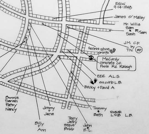
Sidewalk Graffiti (detail)

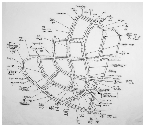
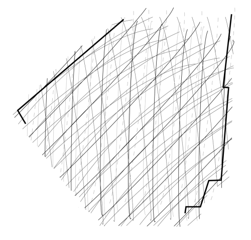
Scratched, scrawled, or stamped into drying concrete—mostly from the 60s into the 80s—is a fragmentary and tragically conventional body of folklore.

Sidewalk Graffiti (click to enlarge)

•••••

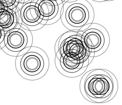
Wind Chimes (detail)

When we did the house types survey, we also paid attention to the presence of wind chimes. They were all over—bamboo, glass, shell, metal tubes. Depending on where you stood, the force of the wind, and the time of day, you could hear several chiming, turning the neighborhood into a carillon.

Wind Chimes (click to enlarge)

•••••

Radio Waves (detail)

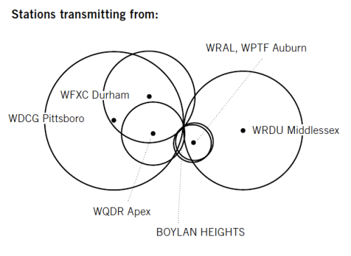
Unlike the wave fronts of wind chimes which—requiring a lot of energy to move the air molecules—never get very large, radio waves don’t propagate in air. They propagate in space and travel undisturbed through non-metallic objects like house walls and bodies. Depending on the location of the transmitter, their wave fronts can be enormous, yet they pass through the neighborhood silently, unfelt, and unnoticed, unless tuned into. In the mid-1980s, Boylan Heights listened mostly to a mix of Top 40, Oldies, Country, R&B, and talk radio on six radio stations: WDGC transmitting from Pittsboro, WFXC from Durham, WQDR from Apex, WRDU in Middlesex, WRAL and WPTF from Auburn. As the neighborhood has changed, so have the radio stations it listens to. Today, it’s mostly NPR broadcast by WUNC in Chapel Hill.


In the key, Boylan Heights is the point of tangency of these six fronts of radio waves. On the map, you can see which waves belong to which stations by their shape and direction. Because radio waves are concave to their point of origin, a wave concave to the lower right (southeast) is coming from Auburn, and one concave to the upper left (northwest) is from Durham. The degree of curvature depends on the size of the wave front and its distance from the source: the straighter the line, the farther away the transmitter. (Sensible curvature decreases with size which is why the earth seems flat.) These wave fronts, ever expanding, make different patterns in other places.

Radio waves also come from the stars. Their wave fronts are effectively flat and they come from every direction, silently, unfelt, and unnoticed.

Radio Waves (click to enlarge)

•••••

Read Full Post »

•••••

That a cartographer  could set out on a mission that’s so emotional, so personal, so idiosyncratic, was news to me.    

—Ira Glass, host of This American Life


•••••

Everything Sings: Maps for a Narrative Atlas by Denis Wood with an introduction by Ira Glass. Pub date: Nov. 12.
$28  .  Paper  .  112 pages  .  85 black and white illustrations, including more than 50 maps  .  ISBN: 978-0-9799562-4-9

Preorder

•••••

These maps remind me of all the radio stories I love most. After all, most radio is a boring salaryman, waking up before you and me to announce the headlines or play the hits to some predetermined demographic. Yet some radio stories elbow their way into the world in defiance of that unrelentingly practical mission, with the same goal Denis Wood’s maps have: to take a form that’s not intended for feeling or mystery and make it breathe with human life. —Ira Glass, host of This American Life

•••••


From the Publisher:
Denis Wood has created an atlas unlike any other. Surveying Boylan Heights, his small neighborhood in North Carolina, he subverts the traditional notions of mapmaking to discover new ways of seeing both this place in particular and the nature of place itself. Each map attunes the eye to the invisible, the overlooked, and the seemingly insignificant. From radio waves permeating the air to the location of Halloween pumpkins on porches, Wood searches for the revelatory details in what has never been mapped or may not even be mappable. In his pursuit of a “poetics of cartography,” the experience of place is primary, useless knowledge is exalted, and representation strives toward resonance. Our perception of maps and how to read them changes as we regard their beauty, marvel at their poetry, and begin to see the neighborhoods we live in anew. Everything Sings weaves a multi-layered story about one neighborhood as well as about the endeavor of truly knowing the places which we call home.


See the Siglio Press Facebook page with seven of the Atlas maps.


The Press Release for Everything Sings.

See the previous post (on the Making Maps blog): Denis Wood: A Narrative Atlas of Boylan Heights


Read Full Post »

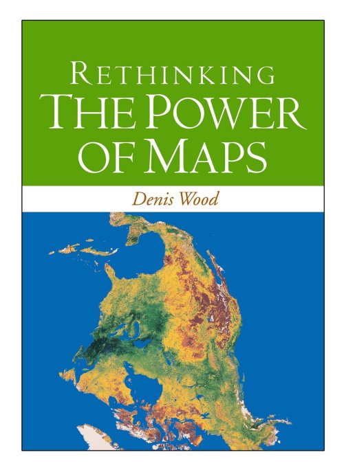
Denis Wood’s followup to his classic The Power of Maps (1992) is almost entirely new in content.  I have included the book’s table of contents below. A PDF copy of chapter 1 is included. This chapter argues, provocatively, “there were no maps before 1500” – a serious challenge to our assumptions about the map as a human and historical universal.

I. Mapping

1. Maps Blossom in the Springtime of the State (PDF)

2. Unleashing the Power of the Map

3. Signs in the Service of the State

4. Making Signs Talk to Each Other

II. Counter-Mapping

5. Counter-Mapping and the Death of Cartography

6. Talking Back to the Map

7. Map Art: Stripping the Mask from the Map

8. Mapmaking, Counter-Mapping, and Map Art in the Mapping of Palestine

Buy a copy of the book here…

From the publisher: “Denis Wood shows how maps are not impartial reference objects, but rather instruments of communication, persuasion, and power. By connecting us to a reality that could not exist in the absence of maps – a world of property lines and voting rights, taxation districts and enterprise zones – they embody and project the interests of their creators.”

Nicholas Chrisman, Department of Geomatic Sciences, Université Laval, says: “Rethinking the Power of Maps sharpens the argument of Wood’s earlier work and focuses its attention on the construction of power. Every student of cartography should take notice.”
Chris Perkins of the University of Manchester says: “In an age when mapping is sexy again Wood explains why it should matter to everyone, explores how maps came to be deployed by states, and how the authority of the image is now being used by many different voices. This is a carefully developed humanist argument for a critical approach to mapping, strongly academic, but reassuringly accessible. Denis Wood’s work always challenges – the passionate style and panache of his scholarship carries the reader along and persuades us to listen to his original ideas.”

Read Full Post »